


Payette River
Payette River
The Payette River is a 62-mile (100 km) river in southwestern Idaho, and is a major tributary of the Snake River.
Its headwaters originate in the Sawtooth and Salmon River mountains at
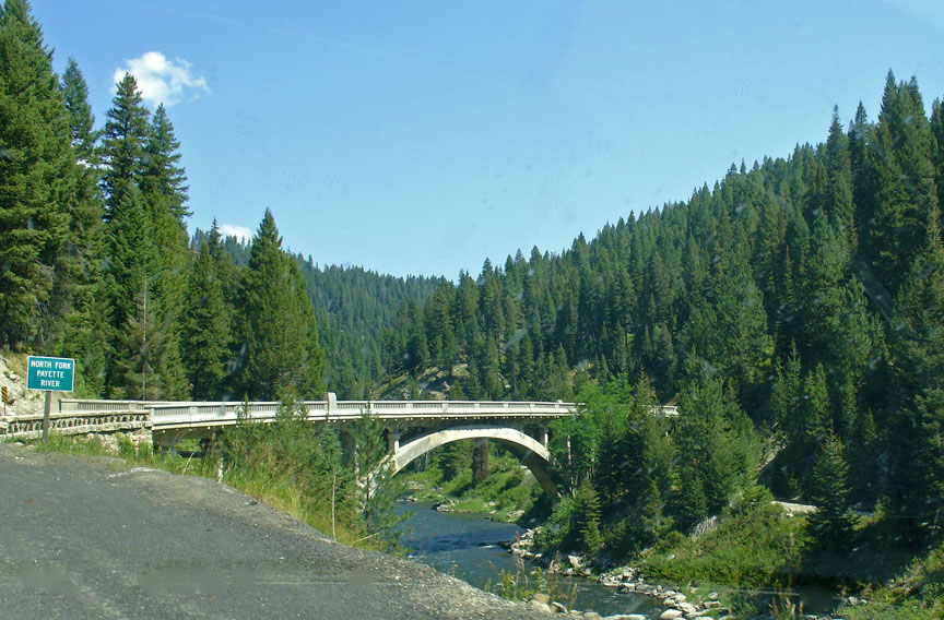
elevations over 10,000 feet (3,000 m). Including the North Fork Payette River,
the drainage flows in a westerly direction for over 175 miles (282 km), while
with the South Fork, the cumulative length exceeds 182 miles (293 km), through
an agricultural valley then empties into the Snake River near the city of
Payette at an elevation of 2,125 feet (648 m). The Payette River's drainage
basin comprises about 3,240 square miles (8,400 km2). It is a physiographic
section of the Columbia Plateau province, which in turn is part of the larger
Intermontane Plateaus physiographic division. The South Fork of the Payette has
its headwaters in the Sawtooth Wilderness, which is part of the Sawtooth
National Recreation Area.
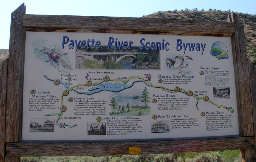
The principal tributaries of the Payette River are the North and South Forks.
The North Fork drains about 950 square miles (2,500 km2), beginning north of
McCall and flowing into Payette Lake. The North Fork exits at the southwest end
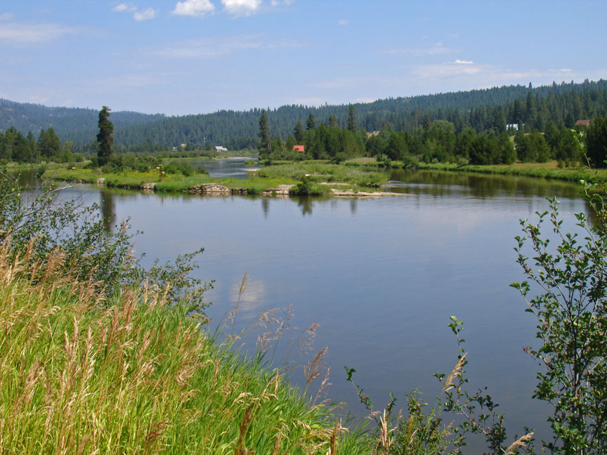
of Payette Lake at 4,990 feet (1,520 m) and flows south in the "Long Valley" of
Valley County toward Cascade. It then flows into the Cascade Reservoir, then
continues south, accompanied by Highway 55.
The South Fork Payette River drains about 1,200 square miles (3,100 km2),
originating on the west side of the Sawtooth Wilderness beneath the 10,211-foot
(3,112 m) Mount Payette. It flows past Grandjean and down to Lowman, along
Highway 21. The shorter Middle Fork Payette River parallels the lower North Fork
10 miles (16 km) to the east, flowing south through Crouch and into the South
Fork. Further east, the Deadwood River parallels the Middle Fork and empties
into the South Fork just west of Lowman. The South Fork is sometimes considered
part of the main stem of the Payette River.
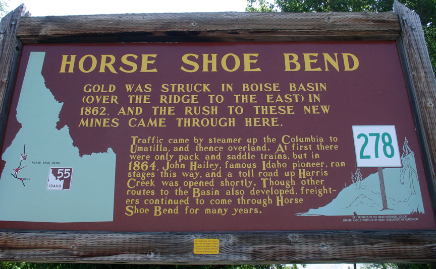
The North and South Forks merge at the village of Banks, at an elevation of
2,790 feet (850 m). This junction is the beginning of the main stem Payette
River, which flows south for 15 miles (24 km) to Horseshoe Bend, then west into
Black Canyon Reservoir. Below the reservoir's dam, the river flows past Emmett
and Payette, then empties into the Snake River at the Oregon border. The Payette
River has an average annual discharge into the Snake River of 2,192,000
acre-feet (2.7 km³) of water (over 700 billion gallons).
The river's watershed was originally settled by the Shoshone, Nez Perce, Paiute and Bannock Native American tribes. Before white contact, many of these indigenous peoples had no permanent villages or settlements. For hundreds of years, in the fall and winter, they would camp in the arid grasslands along the main stem of the Payette River, while in spring and summer, they temporarily moved to the lusher upper basin of the North Fork to hunt and fish in preparation for the coming winter. Camas bulbs, coming from a widespread flowering plant in the basin, was their primary staple throughout the year. In order to maintain the naturally occurring fields of camas, they would set controlled fires whenever they left their camps for the biyearly move through the river basin. The seasonal burning came with added benefits, including clearing unwanted vegetation and protecting their campsites from overgrowth.
In the 19th century, white settlers began moving into western Idaho and
established trading posts, towns and farms in the area. One of these early
pioneers was Francois Payette, for whom the river is named. A French-Canadian
fur trapper who worked for the North West Company, he was one of the first
people of European descent to settle in the Payette River area. Payette ventured
east from Fort Astoria in 1818. From 1835 to 1844, he headed the Hudson's Bay
Company's Fort Boise trading post near Parma, on the Snake River some distance
south of the Payette River. In 1844, Payette retired to Montreal, still over
twenty years before emigrants began to arrive in great numbers. One of the first
settlements was on Clear Creek, a tributary of the South Fork Payette River.
Many of the Native Americans were unhappy with the new settlers and the great
numbers of pioneers traveling through the area bound for the West Coast for
causing damage to their lands, leading to the Nez Perce War of 1877 and many
small conflicts with miners, ranchers, farmers, homesteaders, and soldiers.
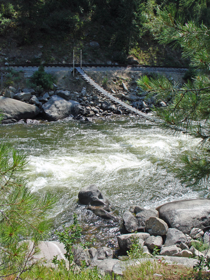
Logging in the basin began soon after the arrival of settlers, but did not reach large scale until the early 20th century. Demand for wooden railroad ties for the Oregon Short Line (OSL) in the 1880s helped to kick off the logging industry in the area. From then on, heavy logging commenced along the North Fork Payette River in Long Valley, downriver of present-day Cascade Lake. A splash dam was built in 1902 by the Minnesota-based Payette Lumber and Manufacturing Company on the North Fork in order to better facilitate the transportation of logs downstream. Logging helped to spur even more people to move into the area, and in 1911, the Idaho Northern Railroad was constructed by the OSL, running from Emmett near the mouth of the Payette along the river, past present-day Black Canyon Reservoir, up into the North Fork watershed and ending in Long Valley at Smith's Ferry on the river, named for a settler who bought the operation in 1891. The ferry's primary purpose was to transport livestock and agricultural products between Long Valley and the Snake River.
Agriculture, however, became the primary mainstay in the lower valley of the
Payette River. Following from 1874, irrigated farmland surrounded much of the
main stem of the Payette River. The Last Chance Canal and Nobel Canal were among
the first irrigation ditches constructed, but did not provide a firm yield
because of the lack of water regulation. Black Canyon Dam was constructed on the
Payette in 1824 not as a storage facility, but to divert water into the Emmett
and Black Canyon Canals, which vastly increased the irrigated acreage in the
valley. Deadwood Dam on the Deadwood River, a tributary of the South Fork
Payette River, was built in 1929 to provide some degree of flow regulation,
though much more effective was the Cascade Dam, constructed on the North Fork in
1948 to form Cascade Lake.
Due to the wide range in elevation, the Payette River has a variety of fish and
fish habitats. Salmon and steelhead were eliminated in the drainage by Black
Canyon Dam, which was first completed in 1924. From its mouth upstream to Black
Canyon Dam, the river supports a mixed fishery for coldwater and warmwater
species. Mountain whitefish make up the bulk of game fish in this section of
river, with smallmouth bass, largemouth bass, channel catfish, black crappie,
rainbow trout, and brown trout making significant contributions. Upstream from
Black Canyon Dam, the gradient of the river increases with coldwater species
increasing in abundance. The South Fork of the Payette River supports excellent
populations of wild rainbow trout. The North Fork of the Payette River has been
severely altered by railroad and highway construction and provides only a
marginal fishery for salmonids. However, in unaltered sections such as the
Cabarton reach, the North Fork is very productive for salmonids.
There are five major impoundments in the Payette basin: Black Canyon, Sage Hen,
Paddock, Cascade, and Deadwood reservoirs. There are also several small
impoundments and natural lakes with increased storage, such as the three Payette
Lakes. Black Canyon, on the mainstem, provides only marginal fish habitat. Sand
from upstream land disturbances has covered most of the habitat. Paddock
Reservoir, on Big Willow Creek, has one of the better populations of black
crappie in the state and a good fishery for largemouth bass. Cascade Reservoir
on the North Fork is one of the most heavily fished waters in the state. Cascade
has an abundance of yellow perch, coho salmon, and rainbow trout. Deadwood
Reservoir, completed in 1931, contains kokanee and cutthroat trout.
Alpine lakes within the Payette River drainage are stocked with rainbow trout,
cutthroat trout, cutbow (rainbow-cutthroat hybrids), golden trout, and arctic
grayling. Brook trout are also present in a number of lakes.
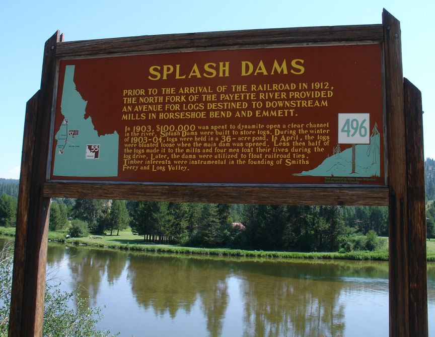
site of splash dams
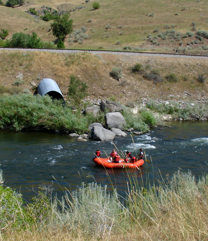
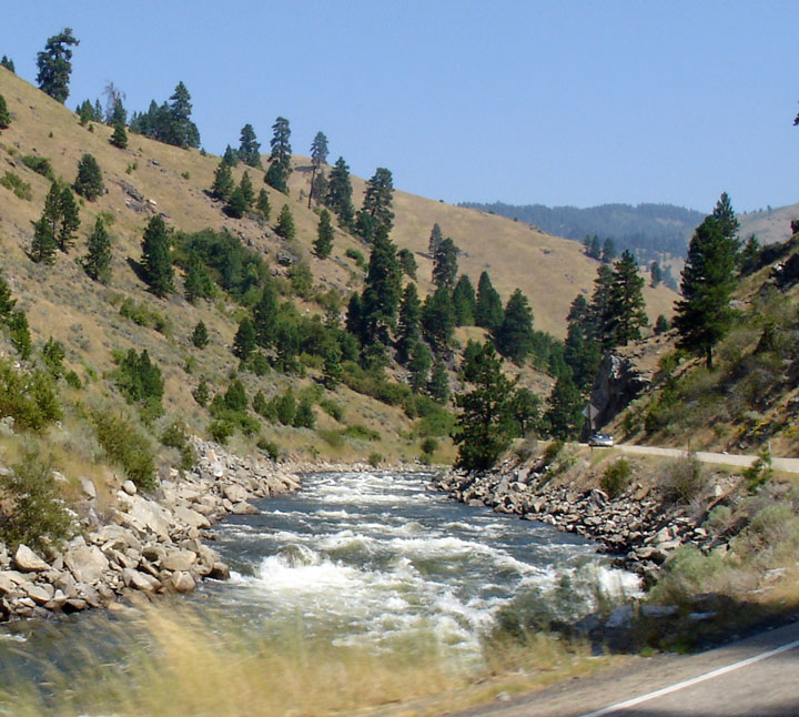
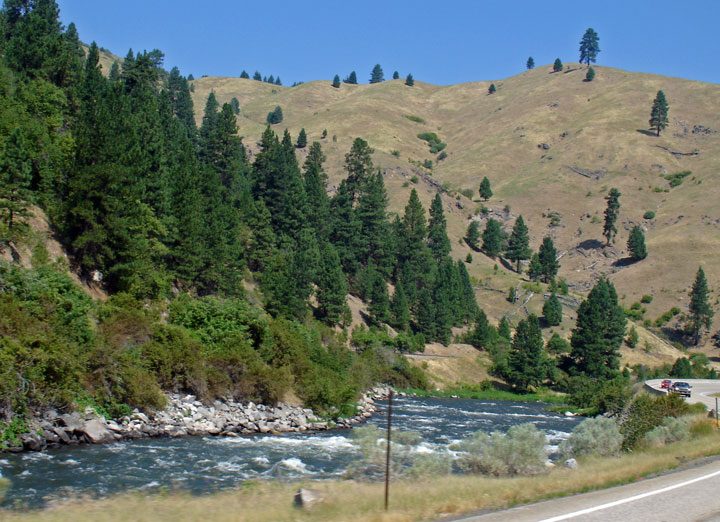
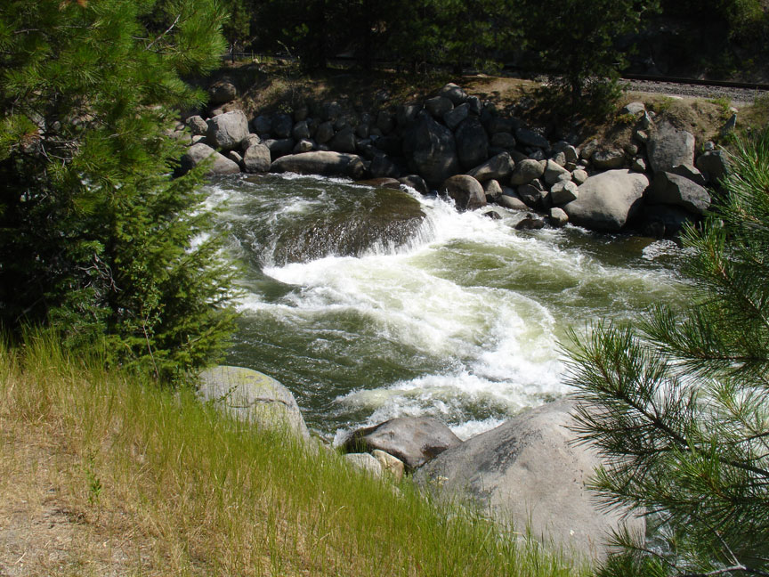
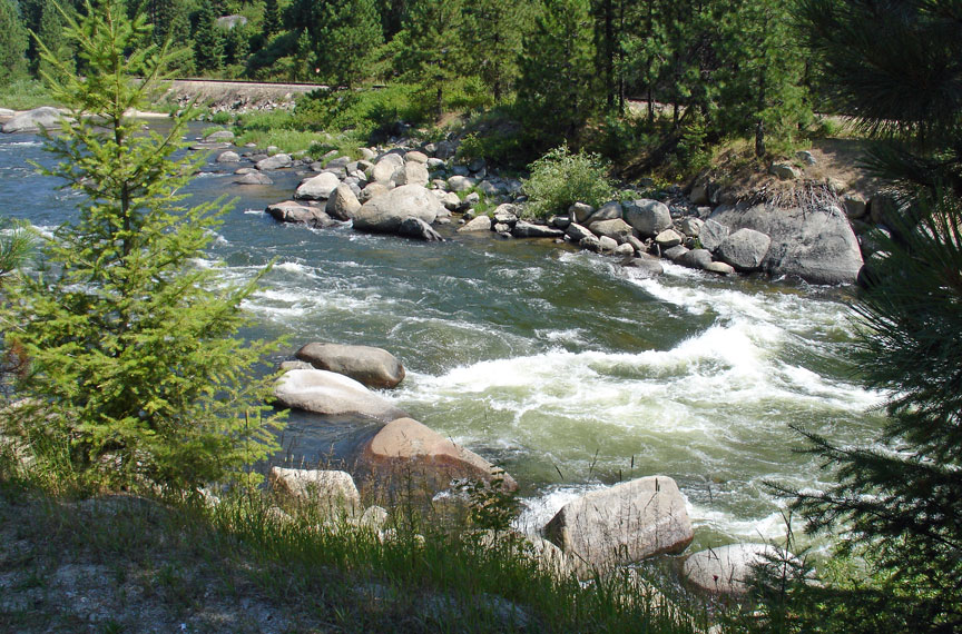
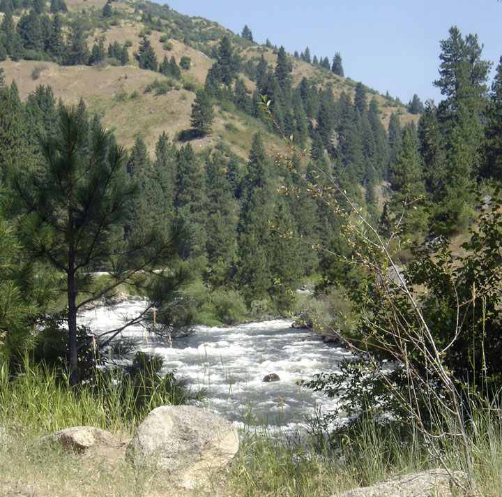
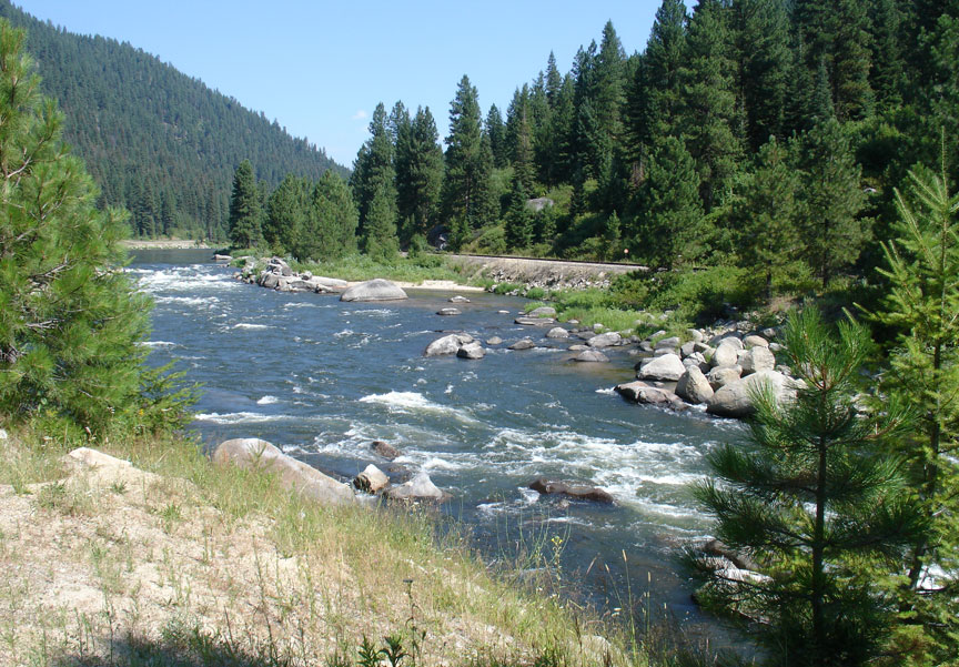
The Payette River is famous for its whitewater. Experts call the North Fork Class V run one of the most challenging river reaches in North America, if not the world. Kayaking on the lower North Fork from Smith's Ferry to Banks is world-class, easily viewed from state highway #55, which closely hugs its bank, primarily on the west side. The lower North Fork narrows and drops 1700 feet (518 m) in the 16 miles (26 km) above Banks, providing nearly endless Class V rapids (see International Scale of River Difficulty). The average gradient is 110 feet per mile (21 m/km) with a maximum gradient of 200 ft/mile (38 m/km). The North Fork's flow rate is controlled through the Cascade Dam, completed in 1948, providing relatively warm water from the shallow Cascade Reservoir.
To the east of Banks, the South Fork's Canyon, west of Lowman, is a challenging
Class IV run for rafting. Along this trip is a 40 foot (13 m) Class VI waterfall
(Big Falls), which is portaged. The North Fork and South Fork merge at Banks to
form the Payette River (main), providing a float trip with numerous Class III
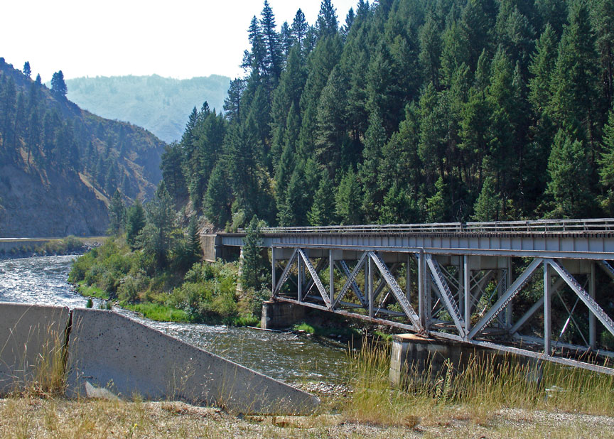
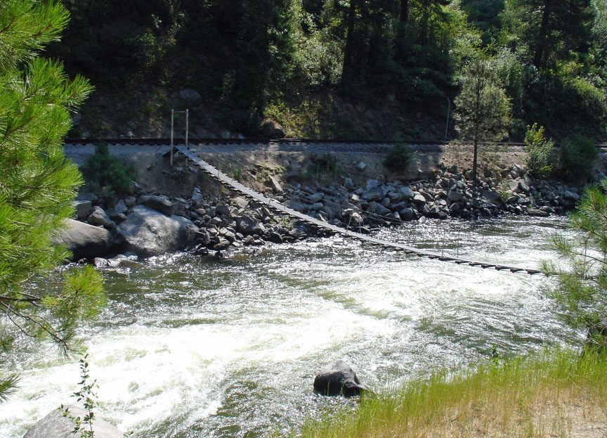
rapids. The highway on this lower stretch of the river is on the east bank and a
scenic railroad, the Thunder Mountain Line , runs above the west side.
Text from Wikipedia
Cascade
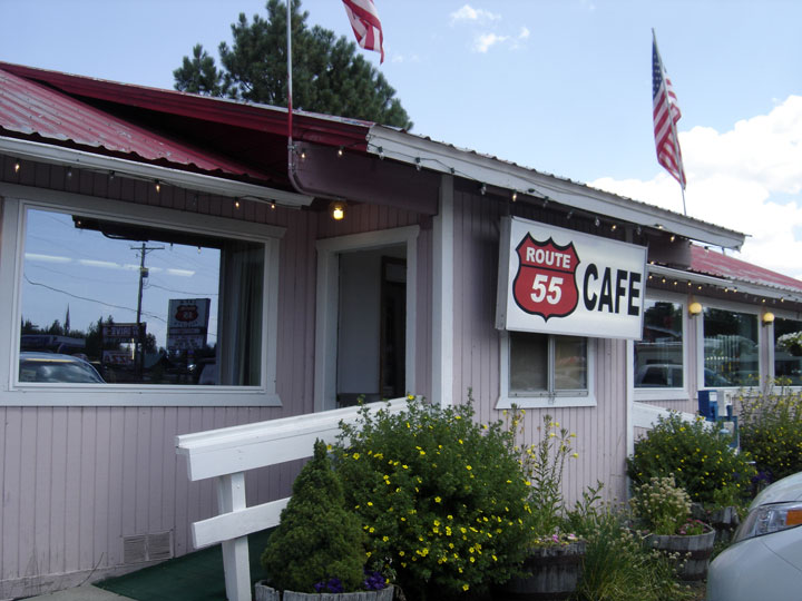
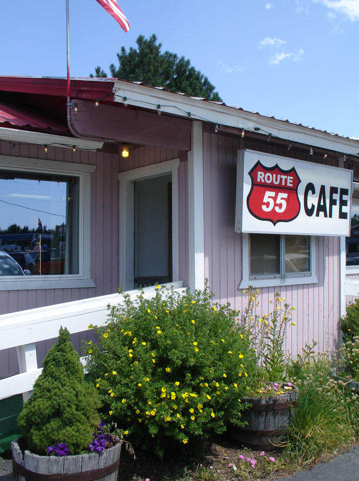
Route 55 Cafe
a smokejumper
soup and burger