


South Dakota


![]()
Sioux Falls
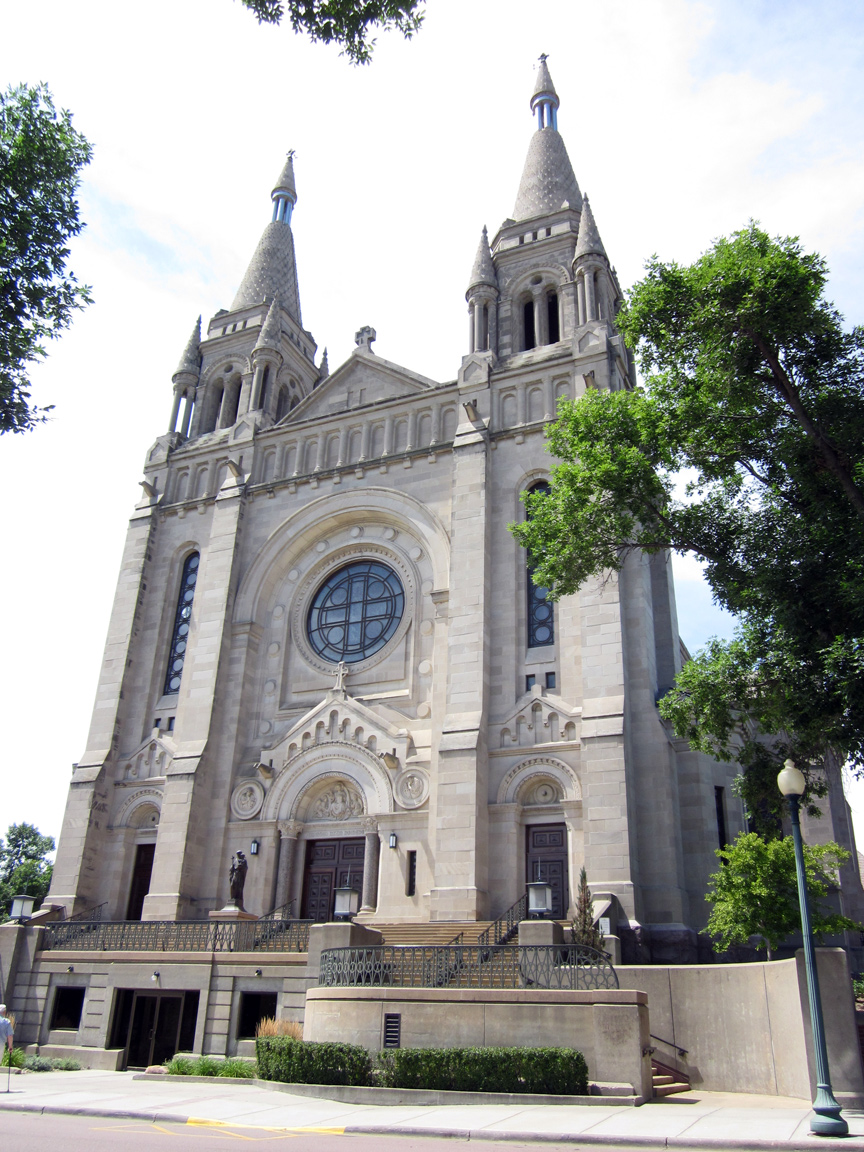
Cathedral of Saint Joseph
![]()
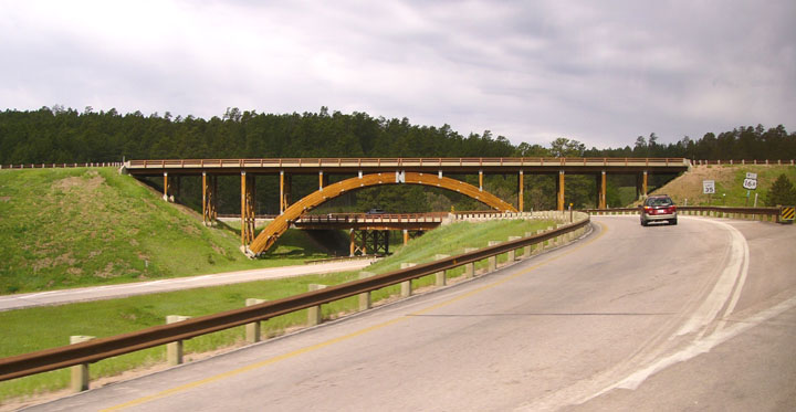
entrance road to Mount Rushmore
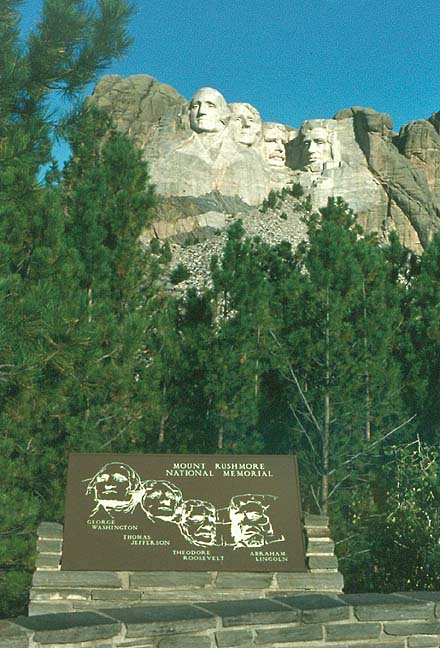
Mount Rushmore
Mount Rushmore National Memorial, national memorial authorized in 1925. Located in southwestern South Dakota, in the Black Hills, the memorial features the heads of United States presidents George Washington, Thomas Jefferson, Abraham Lincoln, and Theodore Roosevelt carved into a granite bluff. The massive sculpture was carved into the rim of Mount Rushmore 150 m (500 ft) above the valley floor and are each 20 m (60 ft) tall. The memorial cost nearly $1 million to create. The idea for creating the sculpture in the Black Hills came from South Dakota historian Doane Robinson in the early 1920s.
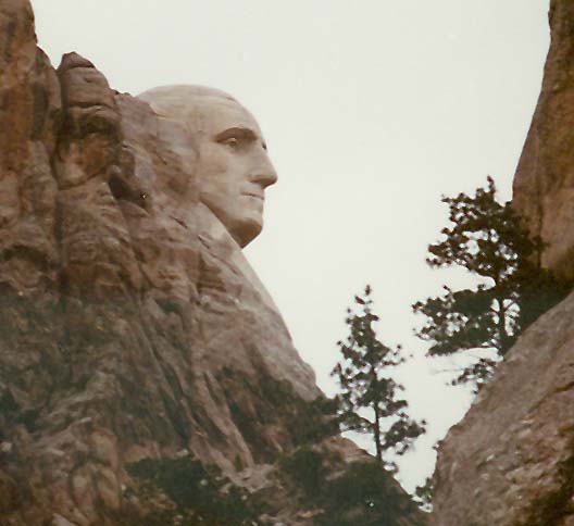
Washington peaking from behind the granite bluff
American sculptor Gutzon Borglum designed the memorial and supervised its construction. Borglum envisioned a monument to the growth of the United States and its most important leaders and chose Mount Rushmore as the site. Borglum’s original design was a sculpture of the four presidents down to their waists. Construction of the memorial began in 1927. The head of Washington was completed first, followed by Jefferson and Lincoln. Roosevelt’s head was unfinished when Borglum died in 1941 and his son Lincoln completed the work later that year. Borglum’s studio, located near the memorial, displays plaster models and tools used in creating the statues. Administered by the National Park Service. Area, 517 hectares (1,278 acres).
Text from Microsoft Encarta
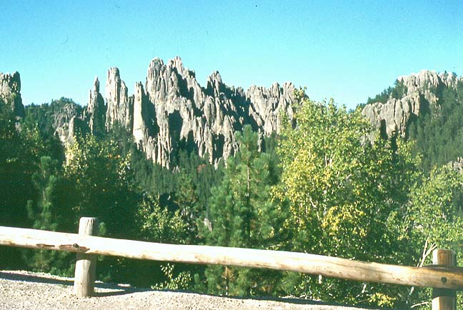
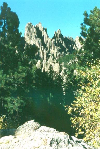
Needles Highway, Black Hills
Black Hills, mountainous region in the western United States, in northeastern Wyoming and western South Dakota. The average elevation of the region, which occupies an area of 16,000 sq km (6,000 sq mi), is 1,200 m (4,000 ft). Harney Peak (2,207 m/7,242 ft) in South Dakota is the highest point. To the northeast of Harney Peak is Mount Rushmore (1,745 m/5,725 ft), also in South Dakota, site of the Mount Rushmore National Memorial. The region is drained by the Belle Fourche and Cheyenne rivers. On the slopes of the Black Hills are heavy stands of timber, mainly conifers. Nearly 4,900 sq km (1,900 sq mi) of the forested areas are managed as a national forest. The region is one of the richest gold-mining districts in the United States and contains a wide variety of other mineral resources, including silver, lead, copper, tin, iron ore, coal, petroleum, salt, mica, and gypsum.
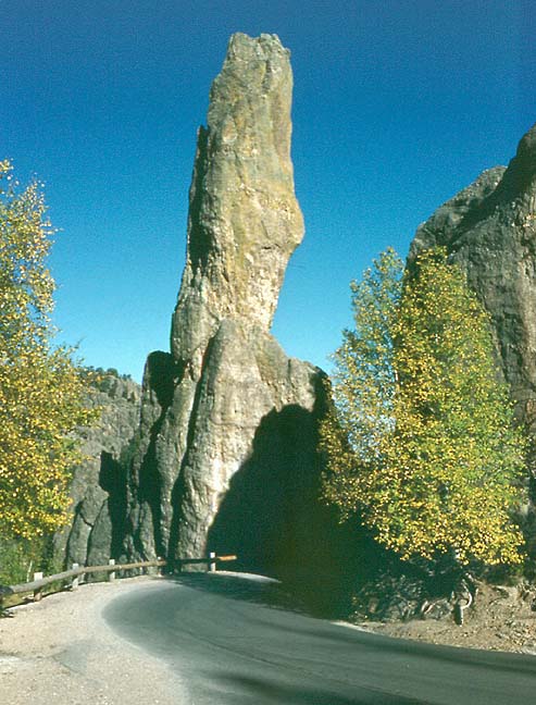
one of the needles
The Black Hills were once part of a Sioux Native American reservation. However, the Sioux were forced out of the region after gold was discovered there in 1874. In 1980 the Supreme Court of the United States ruled that the Sioux should be paid $122.5 million in compensation and interest for the seized land. However, the Sioux have consistently resisted accepting the money because they still want their land returned.Text from Microsoft Encarta
![]()
Wind Cave National Park
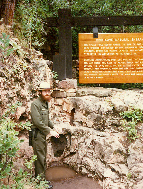
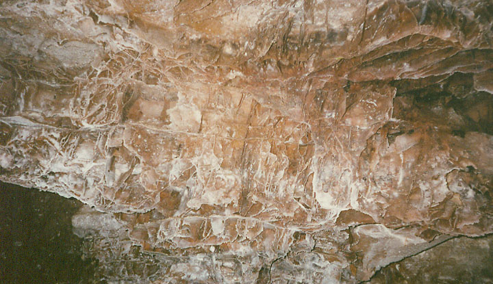
natural entrance to the cave
The cave is well known for its outstanding display of boxwork, an unusual cave formation composed of thin calcite fins resembling honeycombs.
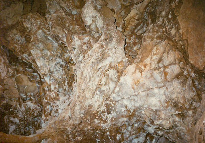
boxwork
The park's mixed grass prairie is one of the few remaining and is home to
native wildlife such as bison, elk, pronghorn, mule deer, coyotes, and
prairie dogs.
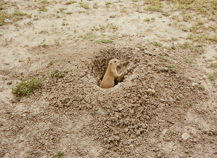
prairie dog
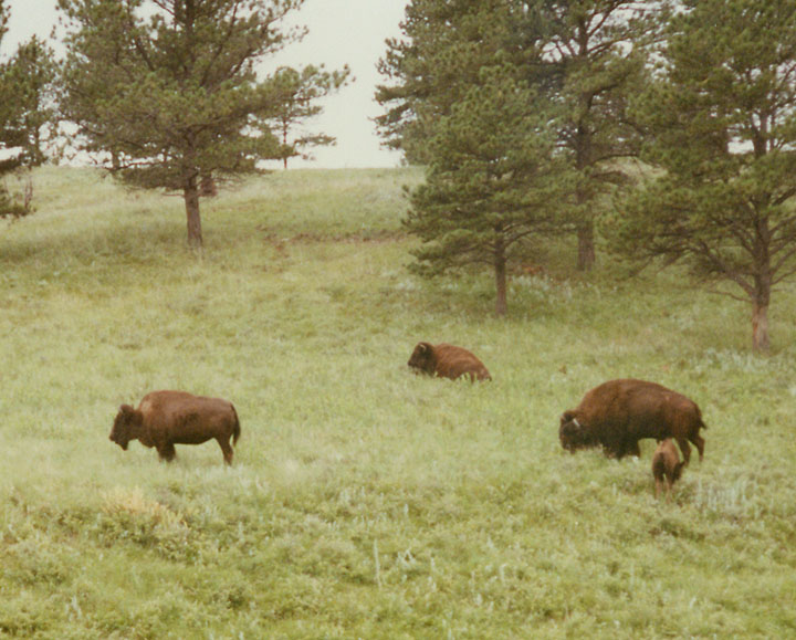
Family group of Bison in South Dakota
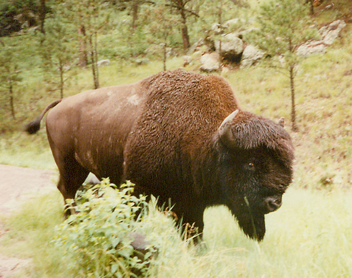
male Bison
![]()
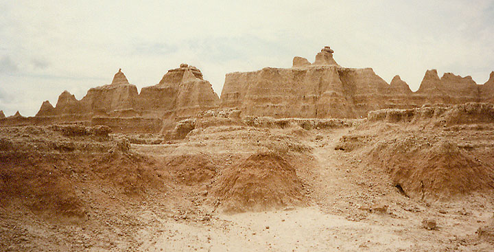
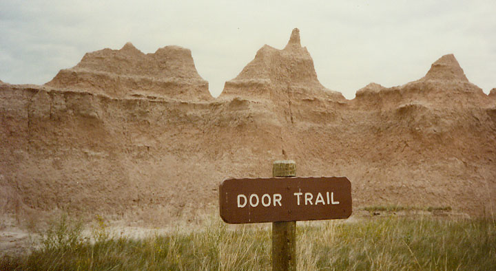
badlands
The Badlands are a work of art still in progress. Water and wind continue to sculpt the pliant soil into sharply eroded buttes, pinnacles, and spires that resemble medieval castles made of sand. It's in the golden light of sunrise or sunset that the artistry is on full display, when the duff-colored soils glow in shades of red, pink, and purple.
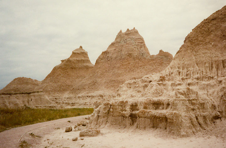
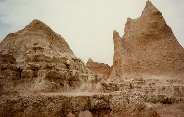
Located in southwestern South Dakota, Badlands National Park consists of 244,000 acres of sharply eroded buttes, pinnacles and spires blended with the largest, protected mixed grass prairie in the United States.
![]()
Mitchell, South Dakota
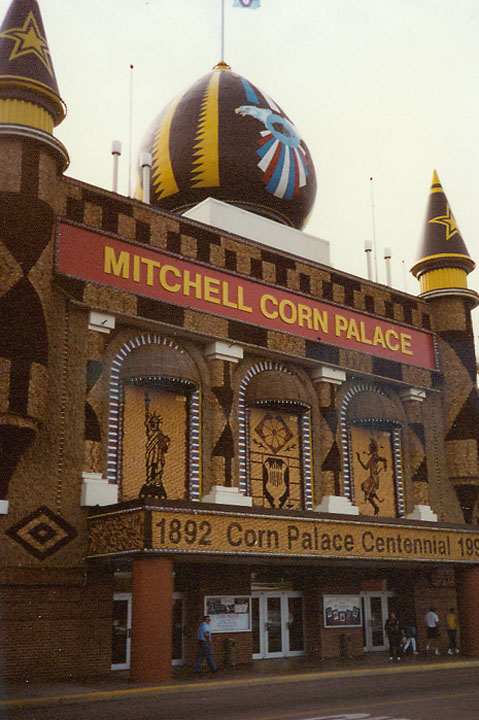
Corn Palace
The citizens of Mitchell built the first Corn Palace in 1892. Early settlers put part of their harvest on the building. This was a way of showing how good their crops were in Dakota. Each year the old decorations were taken down, and new murals were created. These murals are made of thousands of bushels of corn, grain, grasses, wild oats, brome grass, blue grass, rye, straw, and wheat. They tell stories about life in South Dakota. Oscar Howe did the murals that you can see in this picture of the Corn Palace. Today the World's Only Corn Palace still stands as a tribute to the farmers of South Dakota. Sporting and community events take place inside the building.
![]()
Wild Bill Hickok
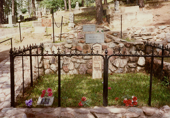
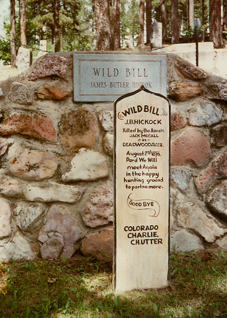
his grave in Deadwood
James Butler Hickok was born in Troy Grove, Illinois, on May 27, 1837, and was shot dead in a saloon in Deadwood, Dakota Territory, on August 2, 1876. Famous for his lethal gun skills, as well as his professional gambling, he was a U.S. town marshal who unsuccessfully tried show business for a while after he got fired from his marshal job for shooting more than just bad guys.
![]()
Minuteman Missile Silos
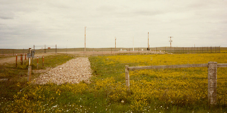
an underground missile silo site
After installation of the missile silos in the farm fields of South Dakota's Western Plains, the missiles went largely unnoticed. Housed underground, the missiles were largely inconspicuous. By the end of 1963 three Strategic Missile Squadrons (SMS) each with five flights of ten Minuteman missiles stood on alert across 13,500 square miles of the Western Plains of South Dakota.
![]()


![]()