


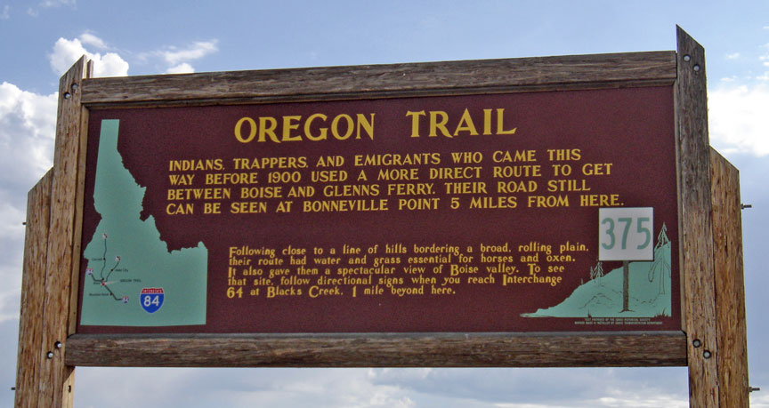
Oregon Trail
Oregon and California trails
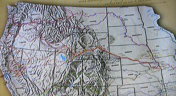
The Oregon Trail was one of the main overland migration routes on the North American continent, leading from locations on the Missouri River to the Oregon Country.
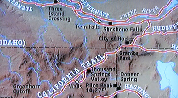
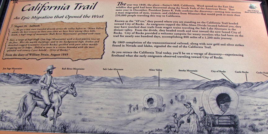
where the California trail diverted
from the Oregon trail
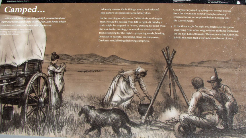
at the City of Rocks Idaho
Between 1841 and 1869 the Oregon Trail was used by settlers, ranchers, farmers, miners, and businessmen migrating to the Pacific Northwest. The eastern half of the trail was also used by travelers on the California Trail, Bozeman Trail, and Mormon Trail which used much of the same trail before turning off to their separate destinations. Once the first transcontinental railroad by the Union Pacific and the Central Pacific was completed in 1869, the use of this trail by long distance travelers rapidly diminished as the railroad was able to fulfill most travel needs. By 1883 the Northern Pacific Railroad had reached Portland, Oregon. Roads were built over or near most of the trail as local travelers traveled to cities originally established along the Oregon Trail.
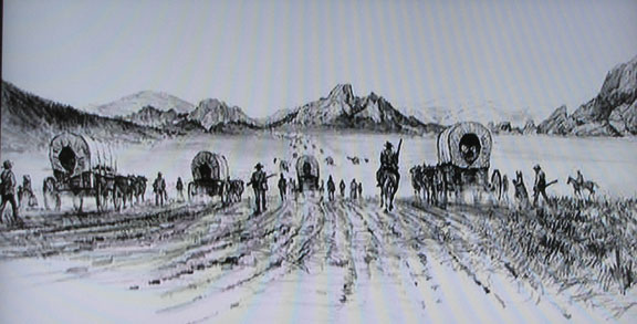
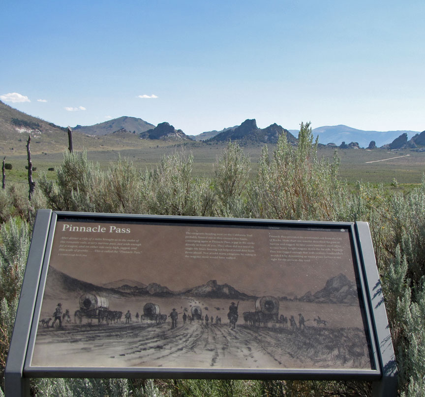
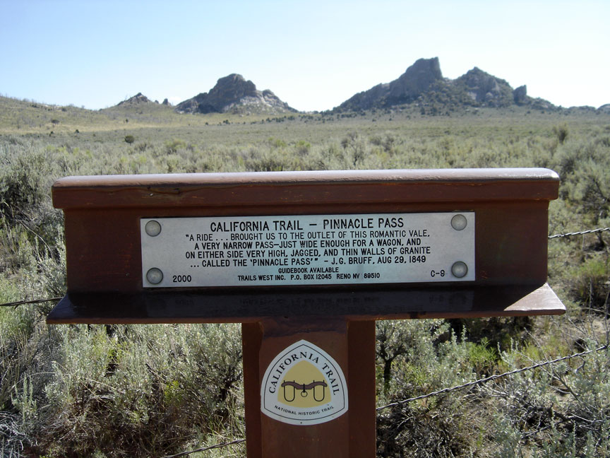
at Pinnacle Pass
To complete the journey in one traveling season most travelers left in April to May—as soon as there was enough grass for forage for the animals and the trails dried out. To meet the constant need for water, grass, and fuel for campfires the trail followed various rivers and streams across the continent. The network of trails required little initial preparation to be made passable for wagons. People using the trail traveled in wagons, pack trains, on horseback, on foot, by raft, and by boat to establish new farms, lives, and businesses in the Oregon Country. This territory in the early 19th century was subject to competing claims by the United States and Britain, who had come to an arrangement usually described as "joint occupancy"; Britain's name for the region was the Columbia District, referring to the local regional department of the Hudson's Bay Company.
The four- to six-month journey spanned over half the continent as the wagon
trail led about 2,000 miles (3,200 km) west through territories and land that
later became six U.S. states: Missouri, Kansas, Nebraska, Wyoming, Idaho, and
Oregon. Extensions of the Oregon Trail were the main arteries that fed settlers
into six more states: Colorado, Utah, Nevada, California, Washington, and
Montana.
In 1803, President Thomas Jefferson issued the following instructions to
Meriwether Lewis "The object of your mission is to explore the Missouri river, &
such principal stream of it, as, by it's course & communication with the
waters of the Pacific Ocean, whether the Columbia, Oregon, Colorado and/or other
river may offer the most direct & practicable water communication across this
continent, for the purposes of commerce." Although Lewis and William Clark
found a path to the Pacific Ocean, it was not until 1859 that a direct and
practicable route, the Mullan Road, connected the Missouri River to the Columbia
River.
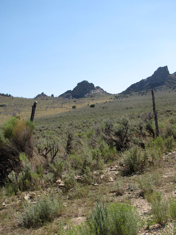
Pinnacle Pass
The first land route across what is now the United States was partially mapped by the Lewis and Clark Expedition between 1804 and 1806. Lewis and Clark initially believed they had found a practical overland route to the west coast; however, the two passes they found going through the Rocky Mountains, Lemhi Pass and Lolo Pass, turned out to be much too difficult for wagons to pass through without considerable road work. On the return trip in 1806 they traveled from the Columbia River to the Snake River and the Clearwater River over Lolo pass again. They then traveled overland up the Blackfoot River and crossed the Continental Divide at Lewis and Clark Pass and on to the head of the Missouri River. This was ultimately a shorter and faster route than the one they followed west. This route had the disadvantages of being much too rough for wagons and controlled by the Blackfoot Indians. Even though Lewis and Clark had only traveled a narrow portion of the upper Missouri River drainage and part of the Columbia River drainage, these were considered the two major rivers draining most of the Rocky Mountains, and the expedition confirmed that there was no "easy" route through the northern Rocky Mountains as Jefferson had hoped.
In 1810, fur trader, entrepreneur, and one of the wealthiest men in the U.S.,
John Jacob Astor of the American Fur Company, outfitted an expedition (known as
the Astor Expedition or Astorians) under Wilson Price Hunt to find a possible
overland supply route and trapping territory for fur trading posts. Fearing
attack by the Blackfoot Indians, the overland expedition veered south of Lewis
and Clark's route into what is now Wyoming and in the process passed across
Union Pass and into Jackson Hole, Wyoming. From there they went over the Teton
Range via Teton Pass and then down to the Snake River in Idaho. They abandoned
their horses at the Snake River, made dugout canoes, and attempted to use the
river for transport. After a few days' travel they soon discovered that steep
canyons, waterfalls and impassable rapids made travel by river impossible. Too
far from their horses to retrieve them, they had to cache most of their goods
and walk the rest of the way to the Columbia River where they made new boats and
traveled to the newly established Fort Astoria. The expedition demonstrated that
much of the route along the Snake River plain and across to the Columbia was
passable by pack train or wagons with minimal improvements.
In early 1811, the supply ship Tonquin left supplies and men to establish Fort
Astoria (Oregon) at the mouth of the Columbia River, then went on to Puget Sound
for a trading expedition. There it was attacked and overwhelmed by Indians
before being blown up, killing all the crew and many Indians. American Fur
Company partner Robert Stuart led a small group of men back east to report to
Astor. The group planned to retrace the path followed by the overland expedition
up the Columbia and Snake rivers. Fear of Indian attack near Union Pass in
Wyoming forced the group further south where they discovered South Pass, a wide
and easy pass over the Continental Divide. The party continued east via the
Sweetwater River, North Platte River (where they spent the winter of 1812–1813)
and Platte River to the Missouri River, finally arriving in St. Louis in the
spring of 1813. The route they had used appeared to potentially be a practical
wagon route, requiring minimal improvements, and Stuart's journals provided a
meticulous account of most of the route. Because of the War of 1812 and the lack
of U.S. fur trading posts in the Oregon Country, most of the route was unused
for more than 10 years.
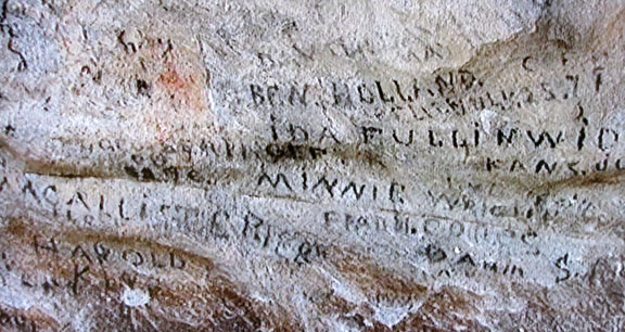
immigrant's names on the rock
at City of Rocks, Idaho
In August 1811, three months after Fort Astor was established, David Thompson and his team of British North West Company explorers came floating down the Columbia to Fort Astoria. He had just completed an epic journey through much of western Canada and most of the Columbia River drainage system. He was mapping the country for possible fur trading posts. Along the way he camped at the confluence of the Columbia and Snake rivers and posted a notice claiming the land for Britain and stating the intention of the North West Company to build a fort on the site (Fort Nez Perces was later established there). In 1812 the North West Company bought Astor's forts, supplies and furs on the Columbia and Snake River and started establishing more of their own.
By 1821, when armed hostilities broke out with their Hudson Bay rivals, the
North West Company was pressured by the British government to merge with the
Hudson's Bay Company. The Hudson's Bay Company had nearly a complete monopoly on
trading (and most governing issues) in the Columbia District, or Oregon Country
as it was referred to by the Americans, and also in Rupert's Land (western
Canada). That year the British parliament passed a statute applying the laws of
Upper Canada to the district and giving the Hudson's Bay Company power to
enforce those laws.
From 1812 to 1840 the British had nearly complete control of the Pacific
Northwest and the western half of the Oregon Trail. In theory, the Treaty of
Ghent ending the War of 1812 restored the U.S. back to its possessions in Oregon
territory. "Joint occupation" of the region was formally established by the
Anglo-American Convention of 1818. The British tried to discourage any U.S.
trappers and traders from doing any significant trapping or trading in the
Pacific Northwest. American fur trappers, traders, missionaries, and later
settlers all worked to break this monopoly. They were eventually successful.
The York Factory Express, establishing another route to the Oregon territory,
evolved from an earlier express brigade used by the North West Company between
Fort Astoria and Fort William, Ontario on Lake Superior. By 1825 the Hudson's
Bay Company started using two brigades, each setting out from opposite ends of
the express route—one from Fort Vancouver on the Columbia River and the other
from York Factory on Hudson Bay—in spring and passing each other in the middle
of the continent. This established a 'quick' (about 100 days for 2,600 miles
(4,200 km)) one way to resupply their forts and fur trading centers as well as
collecting the furs the posts had bought and transmitting messages between Fort
Vancouver and York Factory on Hudson Bay.
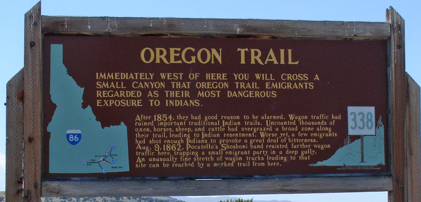
exposure to Indians
The Hudson's Bay Company built a new much larger Fort Vancouver in 1824 slightly upstream of Fort Astoria on the Washington side of the Columbia River (they were hoping the Columbia would be the Canada – U.S. border). The fort quickly became the center of activity in the Pacific Northwest. Every year ships would come from London (via the Pacific—the Cape, or the Horn) to drop off supplies and trade goods in exchange for furs. It was the nexus for the fur trade on the Pacific Coast; its influence reached from the Rocky Mountains to the Hawaiian Islands, and from Russian Alaska into Mexican-controlled California. At its pinnacle in about 1840, Fort Vancouver and its Factor (manager) watched over 34 outposts, 24 ports, 6 ships, and about 600 employees.
the countryside
When emigration over the Oregon Trail began in earnest in about 1836, for many settlers the fort became the last stop on the Oregon Trail where they could get supplies, aid and help before starting their homestead. Fort Vancouver was the main re-supply point for nearly all Oregon trail travelers until U.S. towns could be established. Fort Colville was established in 1825 on the Columbia river near Kettle Falls as a good site to collect furs and control the upper Columbia River fur trade. Fort Nisqually was built near the present town of DuPont, Washington and was the first Hudson's Bay Company fort on Puget Sound. Fort Victoria was erected in 1843 and became the headquarters of operations in British Columbia, eventually growing into modern-day Victoria, the capital city of British Columbia.
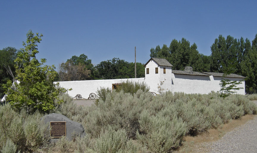
Fort Hall
By 1840 the Hudson's Bay Company had three forts: Fort Hall (purchased from Nathaniel Jarvis Wyeth in 1837), Fort Boise and Fort Nez Perce on the western end of the Oregon Trail route as well as Fort Vancouver near its terminus in the Willamette Valley. With minor exceptions they all gave substantial and often desperately needed aid to the early Oregon Trail pioneers.
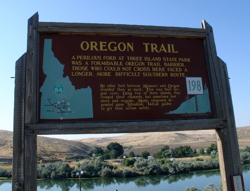
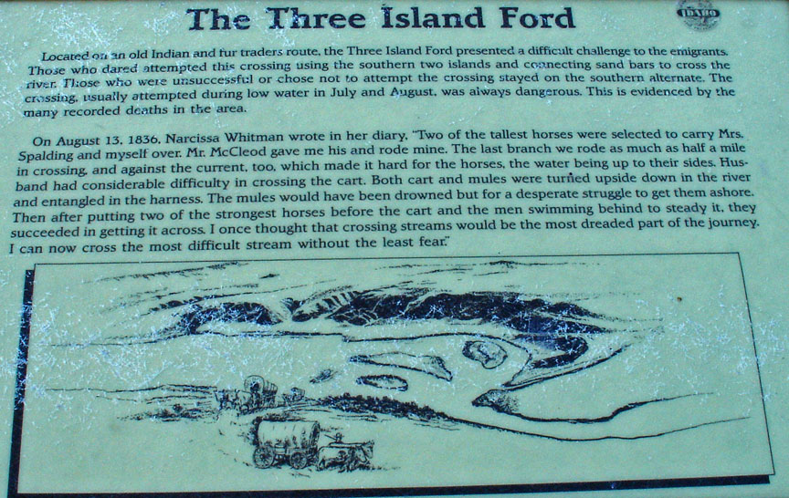
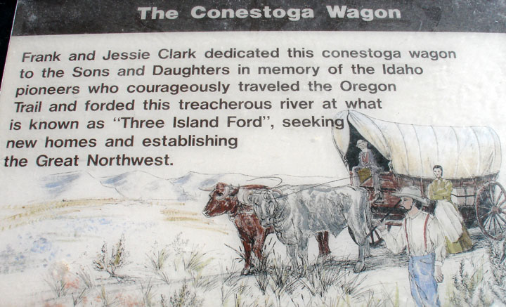
A Perilous Ford
When the fur trade slowed in 1840 because of fashion changes in men's hats, the value of the Pacific Northwest to the British was seriously diminished. Canada had very few potential settlers who were willing to move over 2,500 miles to the Pacific Northwest, although several hundred ex-trappers, British and American, and their families did start settling in Oregon, Washington and California. They used most of the York Express route through northern Canada. In 1841 James Sinclair, on orders from Sir George Simpson, guided nearly 200 settlers from the Red River Settlement (located at the junction of the Assiniboine River and Red River near present Winnipeg, Canada) into the Oregon territory. This attempt at settlement failed when most of the families joined the settlers in the Willamette Valley, with their promise of free land and HBC-free government.
In 1846 the Oregon Treaty ending the Oregon boundary dispute was signed with
Britain. The British lost the land north of the Columbia River they had so long
controlled. The new Canada – United States border was established much further
north at the 49th parallel. The treaty granted the Hudson's Bay Company
navigation rights on the Columbia River for supplying their fur posts, clear
titles to their trading post properties allowing them to be sold later if they
wanted, and left the British with good anchorages at Vancouver and Victoria,
British Columbia. It gave the United States what it mostly wanted, a
'reasonable' boundary and a good anchorage on the West Coast in Puget Sound.
While there were almost no United States settlers in the future state of
Washington in 1846, the United States had already demonstrated it could induce
thousands of settlers to go to the Oregon Territory, and it would be only a
short time before they would vastly outnumber the few hundred Hudson's Bay
Company employees and retirees living in Washington.
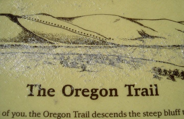
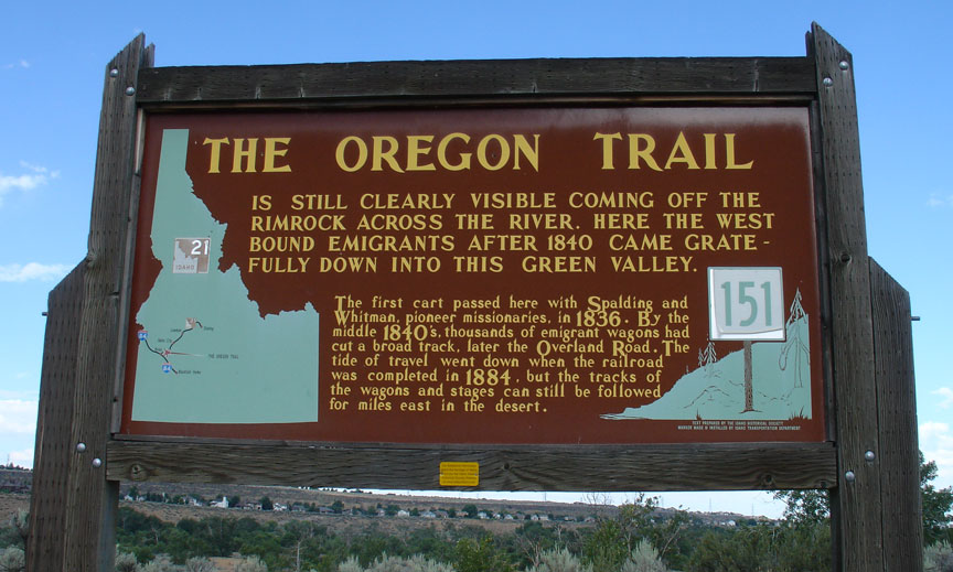
descends the steep bluff prior to the crossing
By overland travel, American missionaries and early settlers (initially mostly ex-trappers) started showing up in Oregon around 1824. Although officially the Hudson's Bay Company discouraged settlement because it interfered with their lucrative fur trade, their Chief Factor at Fort Vancouver, Dr. John McLoughlin, gave substantial help including employment until they could get established. By 1843, when 700–1,000 settlers arrived, the American settlers greatly outnumbered the nominally British settlers in Oregon. McLoughlin, despite working for the British-based Hudson's Bay Company, gave help in the form of loans, medical care, shelter, clothing, food, supplies and seed to United States emigrants. These new emigrants often arrived in Oregon tired, worn out, nearly penniless, with insufficient food or supplies just as winter was coming on. McLoughlin would later be hailed as the Father of Oregon.
Reports from expeditions in 1806 by Lieutenant Zebulon Pike and in 1819 by Major
Stephen Long described the Great Plains as "unfit for human habitation" and as
"The Great American Desert". These descriptions were mainly based on the
relative lack of timber and surface water. The images of sandy wastelands
conjured up by terms like "desert" were tempered by the many reports of vast
herds of millions of Plains Bison that somehow managed to live in this
"desert". In the 1840s, the Great Plains appeared to be unattractive for
settlement and were illegal for homesteading until well after 1846—initially it
was set aside by the U.S. government for Indian settlements. The next available
land for general settlement, Oregon, appeared to be free for the taking and had
fertile lands, disease free climate (yellow fever and malaria were prevalent in
much of the Missouri and Mississippi River drainage then), extensive uncut,
unclaimed forests, big rivers, potential seaports, and only a few nominally
British settlers.
Fur trappers, often working for fur traders, followed nearly all possible
streams looking for beaver in the years (1812–1840) the fur trade was
active. Fur traders included Manuel Lisa, Robert Stuart, William Henry
Ashley, Jedediah Smith, William Sublette, Andrew Henry, Thomas Fitzpatrick, Kit
Carson, Jim Bridger, Peter Skene Ogden, David Thompson, James Douglas, Donald
Mackenzie, Alexander Ross, James Sinclair and other mountain men. Besides
discovering and naming many of the rivers and mountains in the Intermountain
West and Pacific Northwest they often kept diaries of their travels and were
available as guides and consultants when the trail started to become open for
general travel. The fur trade business wound down to a very low level just as
the Oregon trail traffic seriously began around 1840.
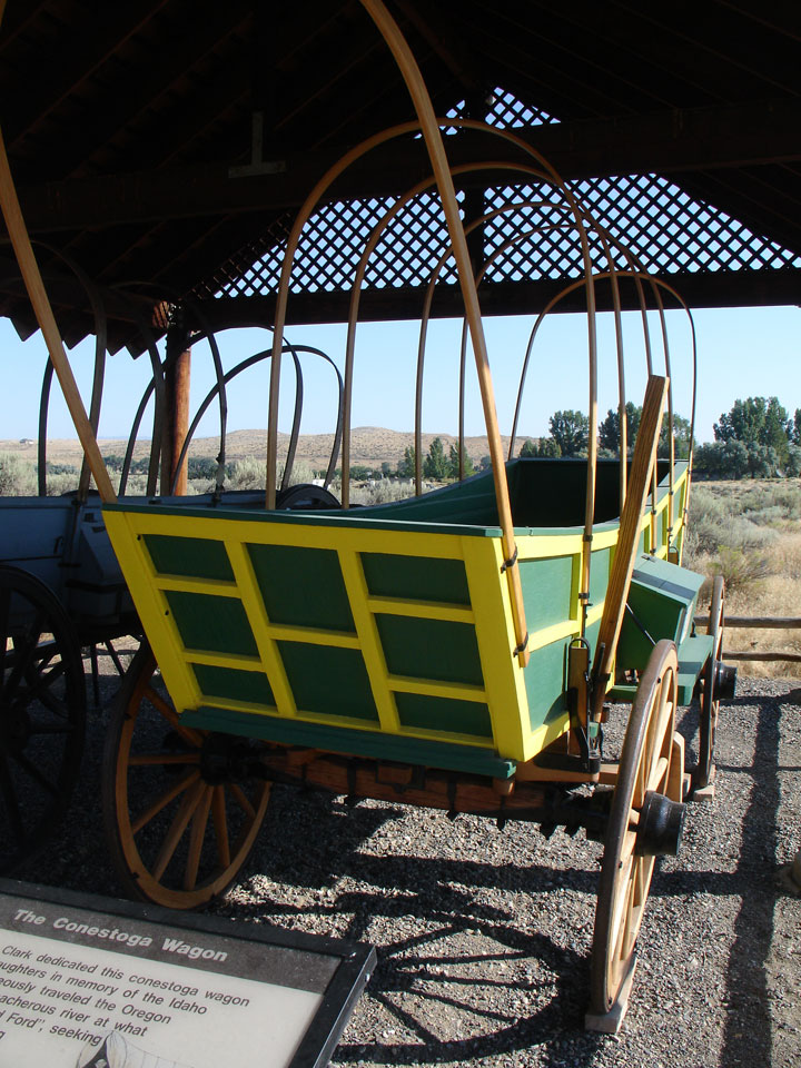
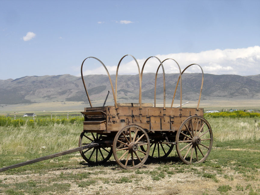
The Conestoga Wagon
In fall of 1823, Jedediah Smith and Thomas Fitzpatrick led their trapping crew south from the Yellowstone River to the Sweetwater River. They were looking for a safe location to spend the winter. Smith reasoned since the Sweetwater flowed east it must eventually run into the Missouri River. Trying to transport their extensive fur collection down the Sweetwater and North Platte River, they found after a near disastrous canoe crash that the rivers were too swift and rough for water passage. On July 4, 1824, they cached their furs under a dome of rock they named Independence Rock and started their long trek on foot to the Missouri River. Upon arriving back in a settled area they bought pack horses (on credit) and retrieved their furs. They had re-discovered the route that Robert Stuart had taken in 1813—eleven years before. Thomas Fitzpatrick was often hired as a guide when the fur trade dwindled in 1840. Jedediah Smith was killed by Indians about 1831.
Up to 3,000 Mountain men were trappers and explorers, employed by various
British and United States fur companies or working as free trappers, who roamed
the North American Rocky Mountains from about 1810 to the early 1840s. They
usually traveled in small groups for mutual support and protection. trapping
took place in the fall when the fur became prime. Mountain men primarily trapped
beaver and sold the skins. A good beaver skin could bring up to $4.00 at a time
when a man’s wage was often $1.00/day. Some were more interested in exploring
the West. In 1825, the first significant American Rendezvous occurred on the
Henry's Fork of the Green River. The trading supplies were brought in by a large
party using pack trains originating on the Missouri River. These pack trains
were then used to haul out the fur bales. They normally used the north side of
the Platte River—the same route used 20 years later by the Mormon Trail. For the
next 15 years the American rendezvous was an annual event moving to different
locations, usually somewhere on the Green River in the future state of Wyoming.
Each rendezvous, occurring during the slack summer period, allowed the fur
traders to trade for and collect the furs from the trappers and their Indian
allies without having the expense of building or maintaining a fort or wintering
over in the cold Rockies. In only a few weeks at a rendezvous a year's worth of
trading and celebrating would take place as the traders took their furs and
remaining supplies back east for the winter and the trappers faced another fall
and winter with new supplies. Jim Beckwourth describes: "Mirth, songs, dancing,
shouting, trading, running, jumping, singing, racing, target-shooting, yarns,
frolic, with all sorts of extravagances that white men or Indians could invent."
In 1830, William Sublette brought the first wagons carrying his trading goods up
the Platte, North Platte, and Sweetwater River (Wyoming) before crossing over
South Pass to a fur trade rendezvous on the Green River near the future town of
Big Piney, Wyoming. He had a crew that dug out the gullies and river crossings
and cleared the brush where needed. This established that the eastern part of
most of the Oregon Trail was passable by wagons. In the late 1830s the Hudson's
Bay Company instituted a policy intended to destroy or weaken the American fur
trade companies. The Hudson's Bay Company's annual collection and re-supply
Snake River Expedition was transformed to a trading enterprise. Beginning in
1834, it visited the American Rendezvous to undersell the American
traders—losing money but undercutting the American fur traders. By 1840 the
fashion in Europe and Britain shifted away from the formerly very popular beaver
felt hats and prices for furs rapidly declined and the trapping almost ceased.
Fur traders tried to use the Platte River, the main route of the eastern Oregon
Trail, for transport but soon gave up in frustration as its many channels and
islands combined with its muddy waters were too shallow, crooked and
unpredictable to use for water transport. The Platte proved to be unnavigable.
The Platte River and North Platte River valley, however became an easy roadway
for wagons, with its nearly flat plain sloping easily up and heading almost due
west.
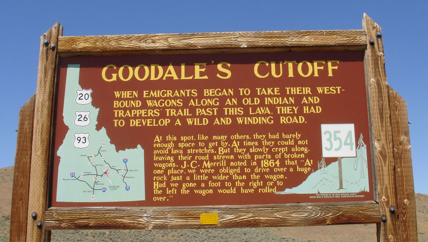
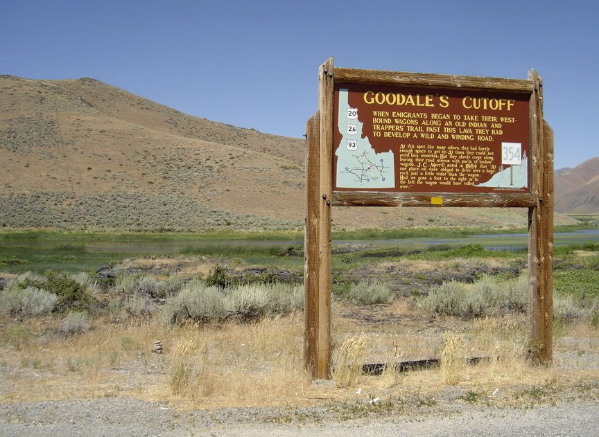
Gooddale's Cutoff
There were several U.S. government sponsored explorers who explored part of the Oregon Trail and wrote extensively about their explorations. Captain Benjamin Bonneville on his expedition of 1832 to 1834 explored much of the Oregon trail and brought wagons up the Platte, North Platte, Sweetwater route across South Pass to the Green River in Wyoming. He explored most of Idaho and the Oregon Trail to the Columbia. The account of his explorations in the west was published by Washington Irving in 1838.). John C. Frémont of the U. S. Army's Corps of Topographical Engineers and his guide Kit Carson led three expeditions from 1842 to 1846 over parts of California and Oregon. His explorations were written up by him and his wife Jessie Benton Frémont and were widely published. The first "decent" map of California and Oregon were drawn by Frémont and his topographers and cartogaphers in about 1848.
Gooddale's Cutoff
In 1834, The Dalles Methodist Mission was founded by Reverend Jason Lee just east of Mount Hood on the Columbia River. In 1836, Henry H. Spalding and Marcus Whitman traveled west to establish the Whitman Mission near modern day Walla Walla, Washington. The party included the wives of the two men, Narcissa Whitman and Eliza Hart Spalding, who became the first European-American women to cross the Rocky Mountains. En route, the party accompanied American fur traders going to the 1836 rendezvous on the Green River in Wyoming and then joined Hudson's Bay Company fur traders traveling west to Fort Walla Walla. The group was the first to travel in wagons all the way to Fort Hall, Idaho, where the wagons were abandoned at the urging of their guides. They used pack animals for the rest of the trip to Fort Walla Walla and then floated by boat to Fort Vancouver to get supplies before returning to start their missions. Other missionaries, mostly husband and wife teams using wagon and pack trains, established missions in the Willamette Valley, as well as various locations in the future states of Washington, Oregon, and Idaho.
In 1843, settlers of the Willamette Valley drafted the Organic Laws of Oregon
organizing land claims within the Oregon Country. Married couples were granted
at no cost (except for the requirement to work and improve the land) up to 640
acres (2.6 km2), and unmarried settlers could claim 320 acres (1.3 km2). As the
group was a provisional government with no authority, these claims were not
valid under United States or British law, but they were eventually honored by
the United States in the Donation Land Act of 1850. The Donation Land Act
provided for married settlers to be granted 320 acres (1.3 km2) and unmarried
settlers 160 acres (0.65 km2). Following the expiration of the act in 1854 the
land was no longer free but cost $1.25 per acre ($3.09/hectare) with a limit of
320 acres (1.3 km2)—the same as most other unimproved government land.
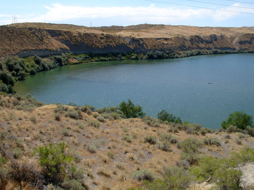
Snake River Valley
On May 1, 1839, a group of eighteen men from Peoria, Illinois, set out with the intention of colonizing the Oregon country on behalf of the United States of America and drive out the Hudson's Bay Company operating there. The men of the Peoria Party were among the first pioneers to traverse most of the Oregon Trail. The men were initially led by Thomas J. Farnham and called themselves the Oregon Dragoons. They carried a large flag emblazoned with their motto "Oregon Or The Grave". Although the group split up near Bent's Fort on the South Platte and Farnham was deposed as leader, nine of their members eventually did reach Oregon.
white topped post indicate the trail location
In September 1840, Robert Newell, Joseph L. Meek, and their families reached Fort Walla Walla with three wagons that they had driven from Fort Hall. Their wagons were the first to reach the Columbia River over land, and they opened the final leg of Oregon Trail to wagon traffic.

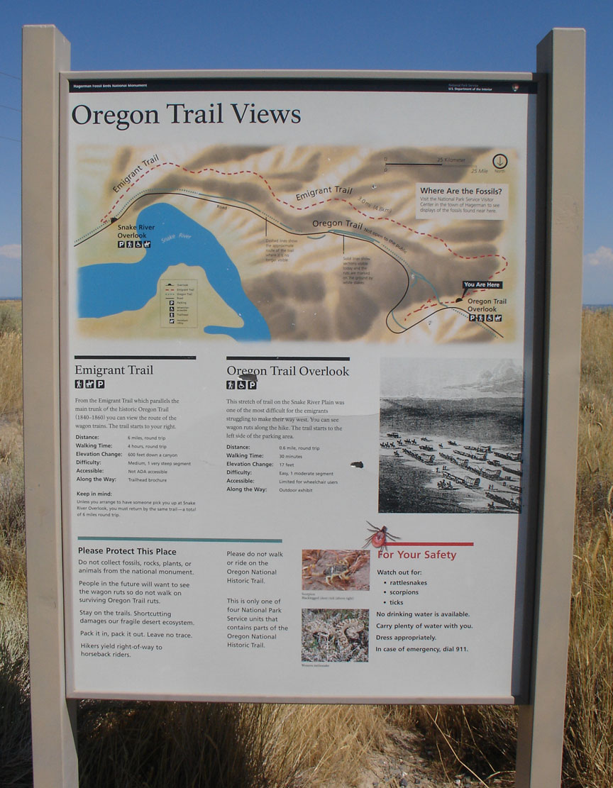
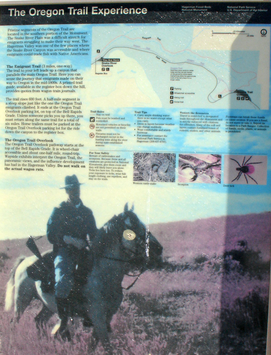
Oregon trail overlook
In 1841 the Bartleson-Bidwell Party was the first emigrant group credited with using the Oregon Trail to emigrate west. The group set out for California, but about half the party left the original group at Soda Springs, Idaho, and proceeded to the Willamette Valley in Oregon, leaving their wagons at Fort Hall.
On May 16, 1842, the second organized wagon train set out from Elm Grove,
Missouri, with more than 100 pioneers. The party was led by Elijah White. The
group broke up after passing Fort Hall with most of the single men hurrying
ahead and the families following later.

emigrant trail
In what was dubbed "The Great Migration of 1843" or the "Wagon Train of 1843", an estimated 700 to 1,000 emigrants left for Oregon. They were led initially by John Gantt, a former U.S. Army Captain and fur trader who was contracted to guide the train to Fort Hall for $1 per person. The winter before, Marcus Whitman had made a brutal mid-winter trip from Oregon to St. Louis to appeal a decision by his Mission backers to abandon several of the Oregon missions. He joined the wagon train at the Platte River for the return trip. When the pioneers were told at Fort Hall by agents from the Hudson's Bay Company that they should abandon their wagons there and use pack animals the rest of the way, Whitman disagreed and volunteered to lead the wagons to Oregon. He believed the wagon trains were large enough that they could build whatever road improvements they needed to make the trip with their wagons. The biggest obstacle they faced was in the Blue Mountains of Oregon where they had to cut and clear a trail through heavy timber. The wagons were stopped at The Dalles, Oregon by the lack of a road around Mount Hood. The wagons had to be disassembled and floated down the treacherous Columbia River and the animals herded over the rough Lolo trail to get by Mt. Hood. Nearly all of the settlers in the 1843 wagon trains arrived in the Willamette Valley by early October. A passable wagon trail now existed from the Missouri River to The Dalles. In 1846, the Barlow Road was completed around Mount Hood, providing a rough but completely passable wagon trail from the Missouri river to the Willamette Valley—about 2,000 miles.
trail experience
Following persecution and mob action in Missouri, Illinois, and other states, and the martyrdom of their prophet Joseph Smith in 1844, Mormon leader Brigham Young was chosen by the leaders of the Latter Day Saints (LDS) church to lead the LDS settlers west. He chose to lead his people to the Salt Lake Valley in present day Utah. In 1847 Young led a small, especially picked fast-moving group of men and women from their Winter Quarters encampments near Omaha, Nebraska, and their approximately 50 temporary settlements on the Missouri River in Iowa including Council Bluffs, Iowa. About 2,200 LDS pioneers went that first year as they filtered in from Mississippi, Colorado, California, and several other states. The initial pioneers were charged with establishing farms, growing crops, building fences and herds, and establishing preliminary settlements to feed and support the many thousands of immigrants expected in the coming years. After ferrying across the Missouri River and establishing wagon trains near what became Omaha, Nebraska, the Mormons followed the northern bank of the Platte River in Nebraska to Fort Laramie in present day Wyoming. They initially started out in 1848 with trains of several thousand emigrants, which were rapidly split into smaller groups to be more easily accommodated at the limited springs and acceptable camping places on the trail. Organized as a complete evacuation from their previous homes, farms, and cities in Illinois, Missouri, and Iowa, this group consisted of entire families with no one left behind. The much larger presence of women and children meant these wagon trains did not try to cover as much ground in a single day as Oregon and California bound emigrants did — typically taking about 100 days to cover the 1,000 miles (1,600 km) trip to Salt Lake City. (The Oregon and California emigrants typically averaged about 15 miles (24 km) per day.) In Wyoming the Mormon emigrants followed the main Oregon/California/Mormon Trail through Wyoming to Fort Bridger, where they split from the main trail and followed (and improved) the crude path established by the ill-fated Donner Party of 1846 into Utah and the Salt Lake Valley.
Between 1847 and 1860 over 43,000 Mormon settlers and tens of thousands of
travelers on the California Trail and Oregon Trail followed Young to Utah. After
1848, the travelers headed to California or Oregon resupplied at the Salt Lake
Valley, and then went back over the Salt Lake Cutoff, rejoining the trail near
the future Idaho-Utah border at the City of Rocks in Idaho.
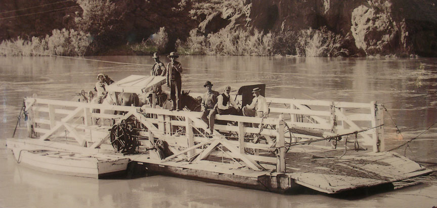
river ferry
Starting in 1855, many of the poorer Mormon travelers made the trek with hand built handcarts and fewer wagons. Guided by experienced guides, handcarts—pulled and pushed by two to four people—were as fast as oxen-pulled wagons and allowed them to bring 75 to 100 pounds (34 to 45 kg) of possessions plus some food, bedding, and tents to Utah. Accompanying wagons carried more food and supplies. Upon arrival in Utah, the handcart pioneers were given or found jobs and accommodations by individual Mormon families for the winter until they could become established. About 3,000 out of over 60,000 Mormon pioneers came across with handcarts.
along the Snake River
Along the Mormon Trail, the Mormon pioneers established a number of ferries and made trail improvements to help later travelers and earn much needed money. One of the better known ferries was the Mormon Ferry across the North Platte near the future site of Fort Caspar in Wyoming which operated between 1848 and 1852 and the Green River ferry near Fort Bridger which operated from 1847 to 1856. The ferries were free for Mormon settlers while all others were charged a toll of from $3.00 to $8.00.
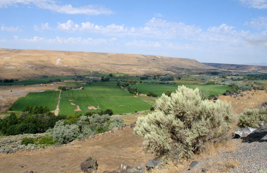
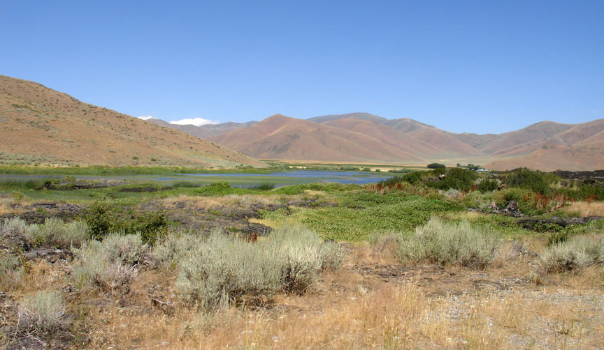
the Green Valley
In January 1848, James Marshall discovered a small nugget of gold in the American River, sparking the California Gold Rush. It is estimated that about two-thirds of the male population in Oregon went to California in 1848 to cash in on the early gold discoveries. To get there, they helped build the Lassen Branch of the Applegate-Lassen Trail by cutting a wagon road through extensive forests. Many returned with significant gold which helped jump-start the Oregon economy. Over the next decade, gold seekers from the Midwestern United States and East Coast of the United States started rushing overland and dramatically increased traffic on the Oregon and California Trails. The "forty-niners" often chose speed over safety and opted to use shortcuts such as the Sublette-Greenwood Cutoff in Wyoming which reduced travel time by almost seven days but spanned nearly 45 miles (72 km) of desert without water, grass, or fuel for fires. 1849 was the first year of large scale cholera epidemics in the United States, and thousands are thought to have died along the trail on their way to California—most buried in unmarked graves in Kansas and Nebraska. The 1850 census showed this rush was overwhelmingly male: the ratio of women to men in California over 16 years was about 1:18. After 1849 the rush continued for several years as the California miners continued to find about $50,000,000 worth of gold per year at $21 per ounce.
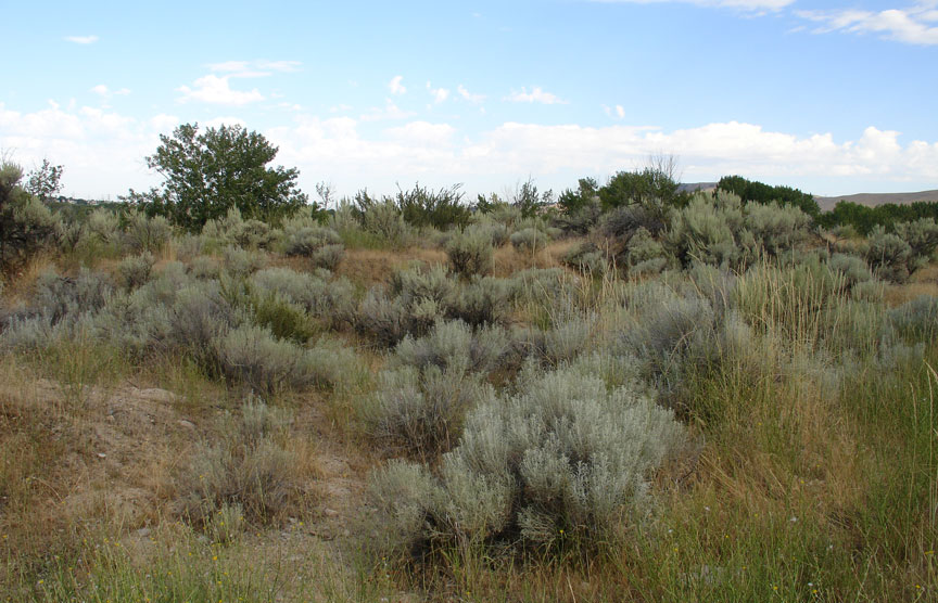
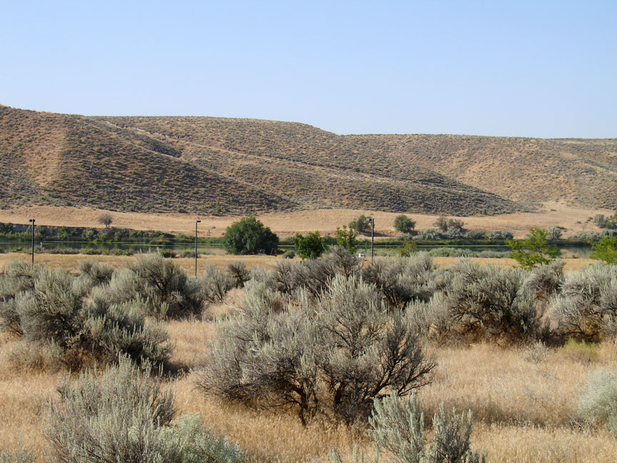
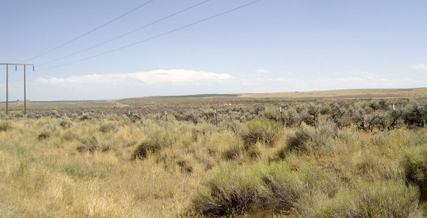
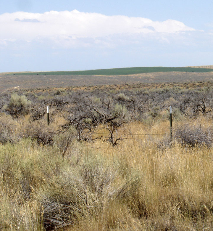
Sage brush along the trail
Overall it is estimated that over 400,000 pioneers used the Oregon Trail and its three primary off-shoots, the California, Bozeman, and Mormon Trails. The trail was still in use during the Civil War, but traffic declined after 1855 when the Panama Railroad across the Isthmus of Panama was completed. Paddle wheel steamships and sailing ships, often heavily subsidized to carry the mail, provided rapid transport to and from the east coast and New Orleans, Louisiana, to and from Panama to ports in California and Oregon.
Over the years many ferries were established to help get across the many rivers
on the path of the Oregon Trail. Multiple ferries were established on the
Missouri River, Kansas River, Little Blue River, Elkhorn River, Loup River,
Platte River, South Platte River, North Platte River, Laramie River, Green
River, Bear River, two crossings of the Snake River, John Day River, Deschutes
River, Columbia River, as well as many other smaller streams. During peak
immigration periods several ferries on any given river often competed for
pioneer dollars. These ferries significantly increased speed and safety for
Oregon Trail travelers. They increased the cost of traveling the trail by
roughly $30.00 per wagon but increased the speed of the transit from about
160–170 days in 1843 to 120–140 days in 1860. Ferries also helped prevent death
by drowning at river crossings.
white topped posts indicated the location of the trail
In April 1859, an expedition of U. S. Corp of Topographical Engineers led by Captain James H. Simpson left Camp Floyd to establish an army supply route across the Great Basin to the eastern slope of the Sierras. Upon return in early August, Simpson reported that he had surveyed two direct and parallel wagon routes. His Northern route from Camp Floyd to Genoa was 283 miles shorter and his Southern route was 312 miles shorter than the old route (Camp Floyd, Salt Lake City, City of Rocks, Humbolt to Genoa). Also, Simpson claimed the distance from the Missouri River to San Francisco would be shortened 41 miles by using his shortest route (South Pass, Salt Lake City, and across the Great Basin) from a second route (Lander Cutoff and the Carson River route) and 55 miles from a third (Lander Cutoff and the Honey Lake road).
the trail
Starting in 1860, after the American Civil War closed the heavily subsidized southern Butterfield Overland Mail stage route to California, several stage lines were set up carrying mail and passengers that traversed much of the route of the original Oregon Trail to Fort Bridger and from there over the Central Overland Route to California. By traveling day and night with many stations and changes of teams (and extensive mail subsidies) these stages could get passengers and mail from the midwest to California in about 25–28 days. In 1860–1861 the Pony Express, employing riders traveling on horseback day and night with relay stations about every ten miles to supply fresh horses, was established from St. Joseph, Missouri, to Sacramento, California. The Pony Express built many of their eastern stations along the Oregon/California/Mormon/Bozeman trails and many of their western stations along the very sparsely settled Central Route across Utah and Nevada. The Pony Express delivered mail summer and winter in roughly ten days from the midwest to California. The Pony Express in 1860-61 shared many of the stage stations already built up by stage lines taking the Central Route. These combined stage and Pony Express stations along the Central Route across Utah and Nevada were joined by the First Transcontinental Telegraph stations and telegraph line which followed much the same route in 1861 from Carson City, Nevada to Salt Lake City, Utah. The Pony Express folded in 1861 as they failed to receive an expected mail contract from the U.S. government and the telegraph filled the need for rapid east-west communication. This combination wagon/stagecoach/pony express/telegraph line route is labeled the Pony Express National Historic Trail on the National Trail Map. From Salt Lake City the telegraph line followed much of the Mormon/California/Oregon trails to Omaha, Nebraska.
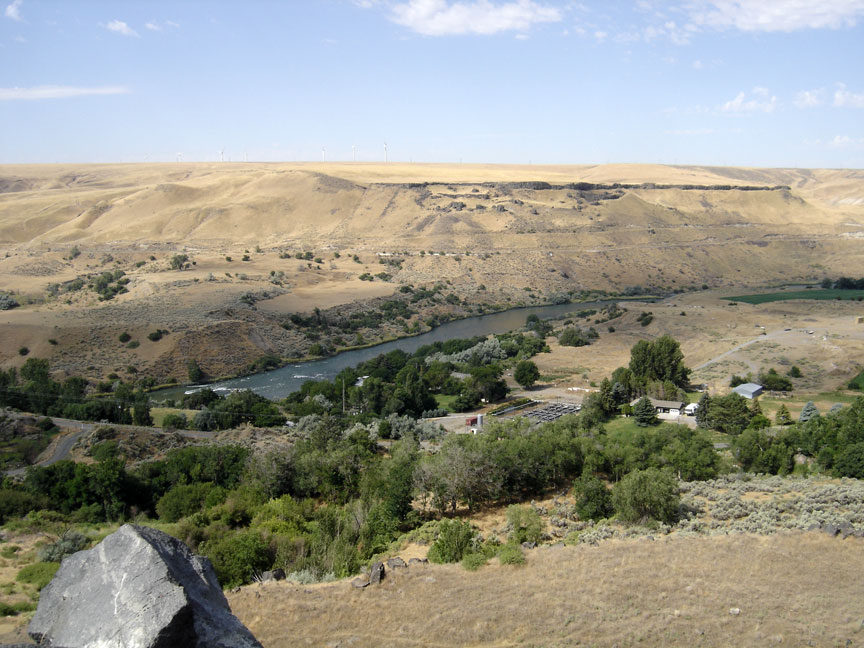
view of the Snake River Valley
After the First Transcontinental Railroad was completed in 1869 all the telegraph lines usually followed the railroad tracks as the required relay stations and telegraph lines were much easier to maintain alongside the tracks. Telegraph lines to unpopulated areas were largely abandoned.
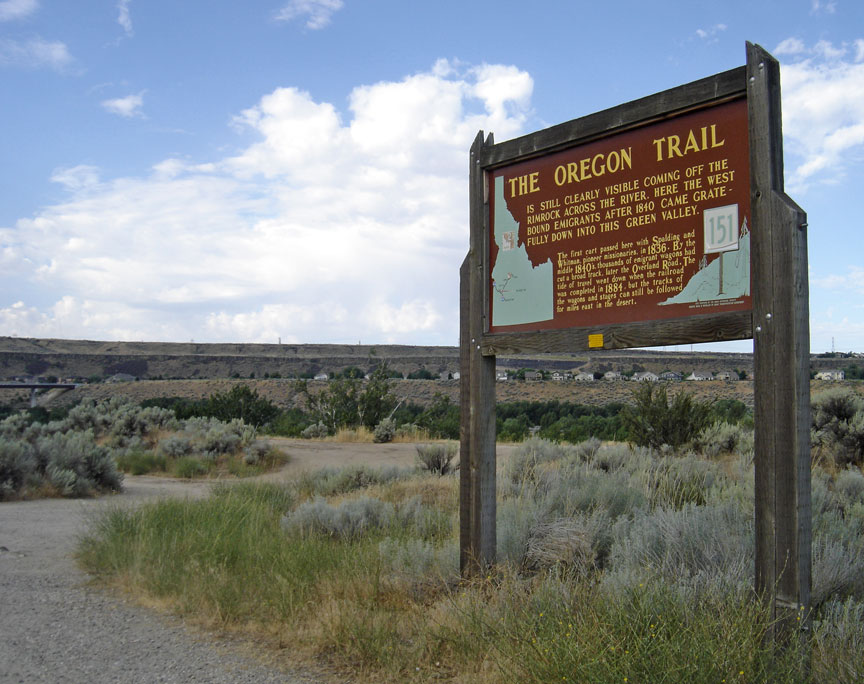
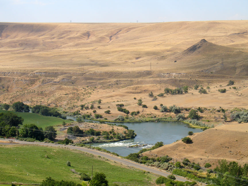
coming off the Rimrock
As the years passed the Oregon Trail became a heavily used corridor from the Missouri River to the Columbia river. Offshoots of the trail continued to grow as gold and silver discoveries, farming, lumbering, ranching, and business opportunities resulted in much more traffic to many areas. Traffic became two-directional as towns were established along the trail. By 1870 the population in the states served by the Oregon Trail and its offshoots increased by about 350,000 over their 1860 census levels. With the exception of most of the 180,000 population increase in California, most of these people living away from the coast traveled over parts of the Oregon trail and its many extensions and cutoffs to get to their new residences.
Glenn's Ferry to Boise
Even before the famous Texas cattle drives after the Civil War, the trail was being used to drive herds of thousands of cattle, horses, sheep, and goats from the midwest to various towns and cities along the trails. According to studies by trail historian John Unruh the livestock may have been as plentiful or more plentiful than the immigrants in many years. In 1852 there was even records of a 1,500 turkey drive from Illinois to California. The main reason for this livestock traffic was the large cost discrepancy between livestock in the midwest and at the end of the trail in California, Oregon, or Montana. They could often be bought in the Midwest for about 1/3 to 1/10th what they would fetch at the end of the trail. Large losses could occur and the drovers would still make significant profit. As the emigrant travel on the trail declined in later years and after livestock ranches were established at many places along the trail large herds of animals often were driven along part of the trail to get to and from markets.
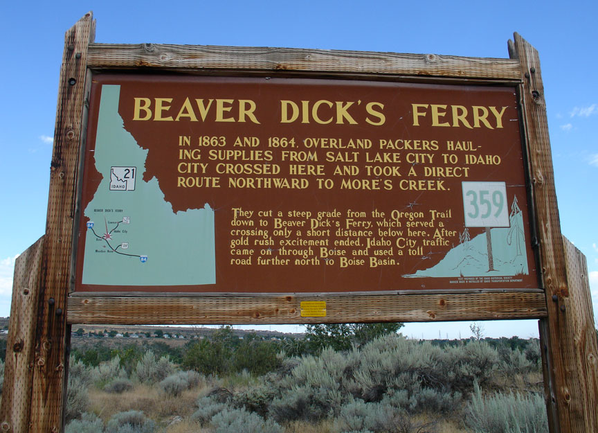
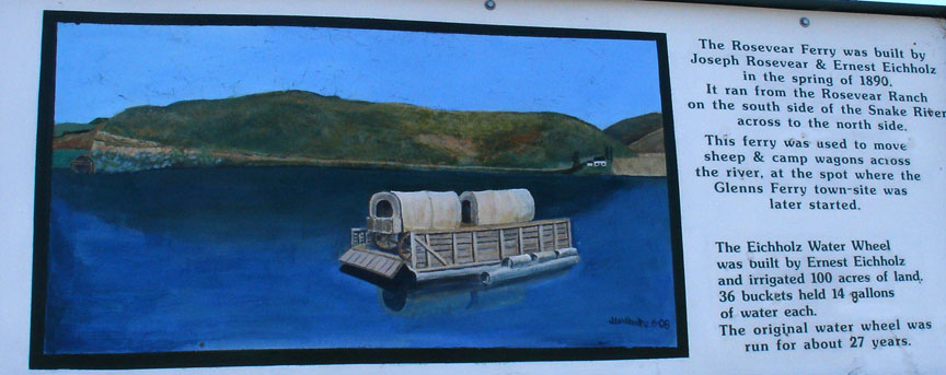
Beaver Dick's Ferry
The first transcontinental railroad was completed in 1869, providing faster, safer, and usually cheaper travel east and west (the journey took seven days and cost as little as $65). Some emigrants continued to use the trail well into the 1890s, and modern highways and railroads eventually paralleled large portions of the trail, including U.S. Highway 26, Interstate 84 in Oregon and Idaho and Interstate 80 in Nebraska. Contemporary interest in the overland trek has prompted the states and federal government to preserve landmarks on the trail including wagon ruts, buildings, and "registers" where emigrants carved their names. Throughout the 20th and 21st centuries there have been a number of re-enactments of the trek with participants wearing period garments and traveling by wagon.
Text from Wikipedia
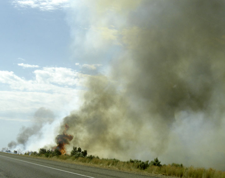
fire along Interstate 84
burning sage