


Craters of the Moon National Monument


Craters of the Moon National Monument
Craters of the Moon National Monument and Preserve is a national monument and national preserve located in the Snake River Plain in central Idaho, U.S.A. It is along US 20 (concurrent with US 93 & US 26), between the small cities of Arco and Carey, at an average elevation of 5,900 feet (1,800 m) above sea level. The protected area's features are volcanic and represent one of the best preserved flood basalt areas in the continental United States.

President Coolidge establishing the Monument
The Monument was established on May 2, 1924. In November 2000, a presidential proclamation by President Clinton greatly expanded the Monument area. The National Park Service portions of the expanded Monument were designated as Craters of the Moon National Preserve in August 2002. It lies in parts of Blaine, Butte, Lincoln, Minidoka, and Power counties. The area is managed cooperatively by the National Park Service and the Bureau of Land Management (BLM).
The Monument and Preserve encompass three major lava fields and about 400 square
miles (1,036 km2) of sagebrush steppe grasslands to cover a total area of 1,117
square miles (2,893 km2). All three lava fields lie along the Great Rift of
Idaho, with some of the best examples of open rift cracks in the world,
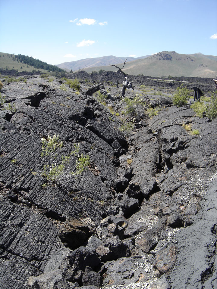
including the deepest known on Earth at 800 feet (240 m). There are excellent
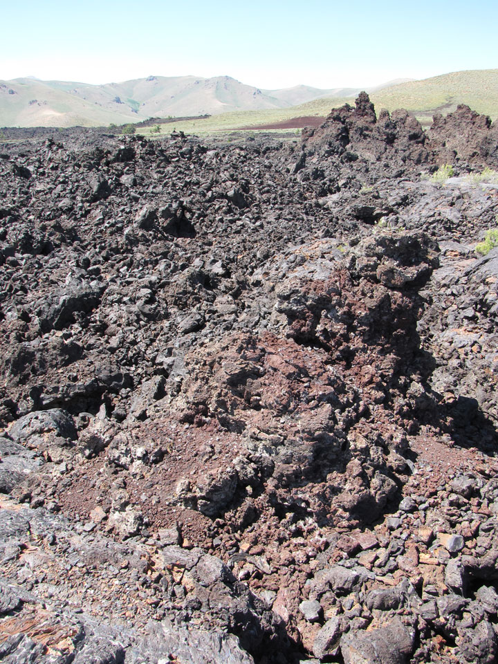
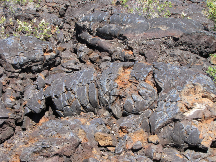
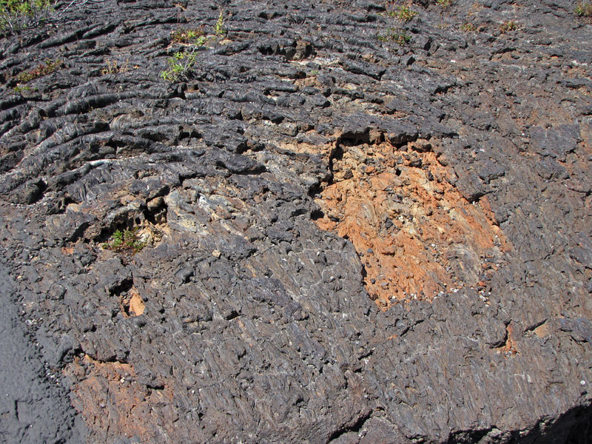
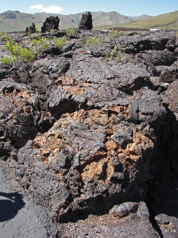
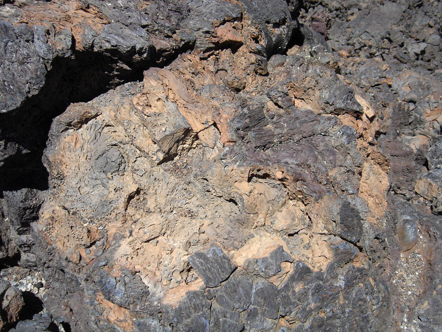
examples of almost every variety of basaltic lava as well as tree molds
(cavities left by lava-incinerated trees), lava tubes (a type of cave), and many
other volcanic features.
Craters of the Moon National Monument (1957)
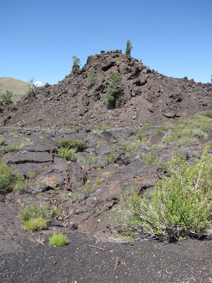
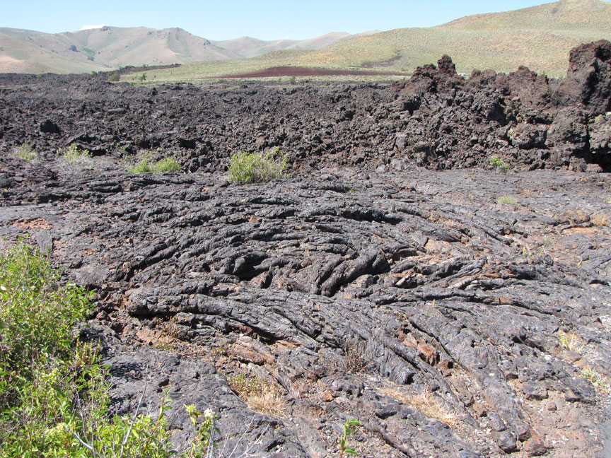
The Craters of the Moon Lava Field spreads across 618 square miles (1,601 km2) and is the largest mostly Holocene-aged basaltic lava field in the lower 48 U.S. states. The Monument and Preserve contain more than 25 volcanic cones including outstanding examples of spatter cones. The 60 distinct lava flows that form the Craters of the Moon Lava Field range in age from 15,000 to just 2,000 years. The Kings Bowl and Wapi lava fields, both about 2,200 years old, are part of the National Preserve.
2010
Craters of the Moon Lava Field reaches southeastward from the Pioneer Mountains. This lava field is the largest of several large beds of lava that erupted from the 53 miles (85 km) south-east to north-west trending Great Rift volcanic zone—a line of weakness in the Earth's crust created by Basin and Range rifting. Together with fields from other fissures they make up the Lava Beds of Idaho, which in turn are located within the much larger Snake River Plain volcanic province. The Great Rift almost extends across the entire Snake River Plain.
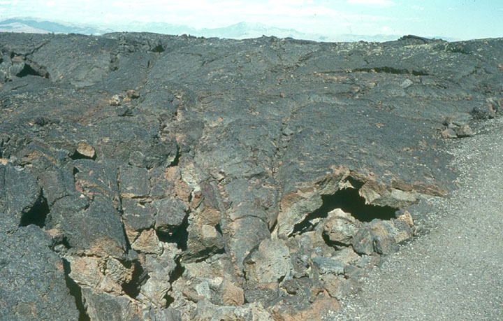
Lava flow
The rugged landscape remains remote and undeveloped with only one paved road across the northern end. Craters of the Moon is located in south-central Idaho midway between Boise and Yellowstone National Park, and its elevation at the visitor center is 5,900 feet (1,800 m) above sea level. Combined U.S. Highway 20-26-93 cuts through the northwestern part of the monument and provides access to it.
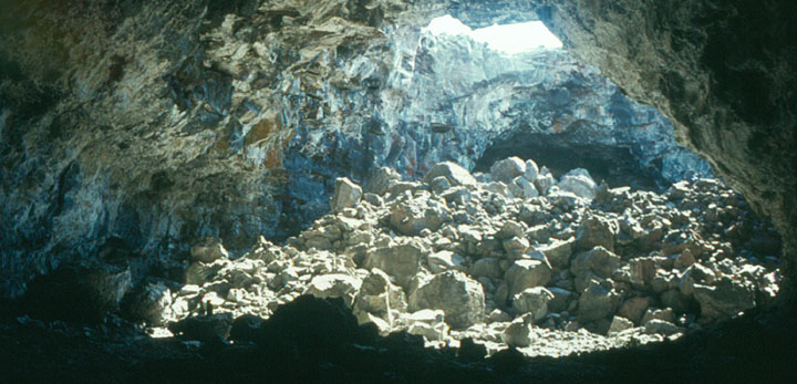
entrance into a lava tube
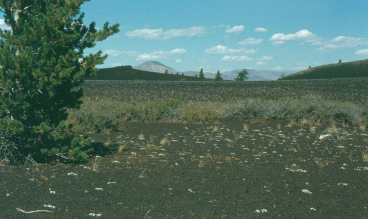
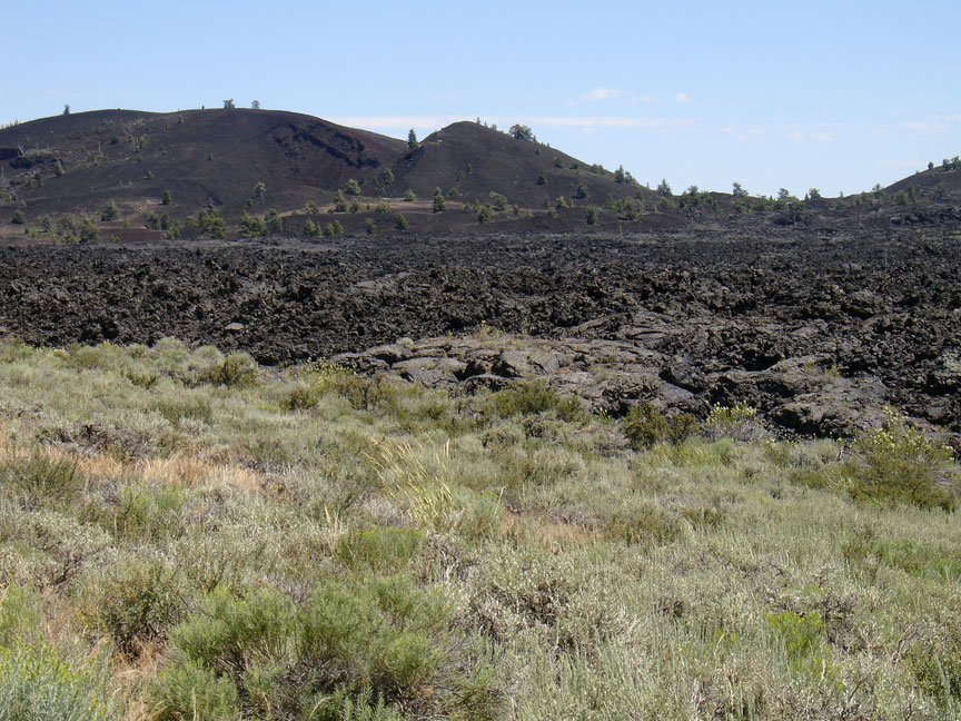
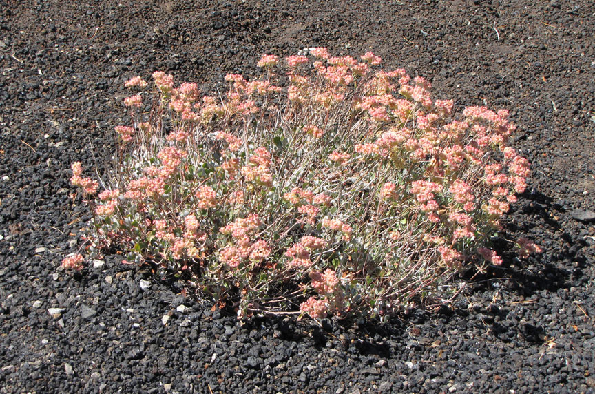
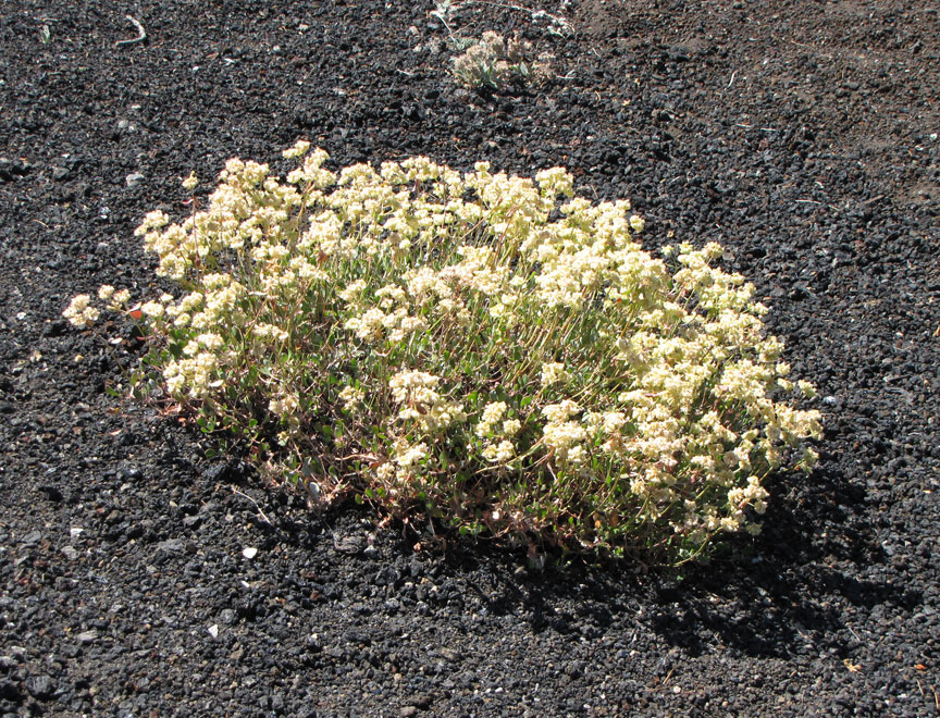
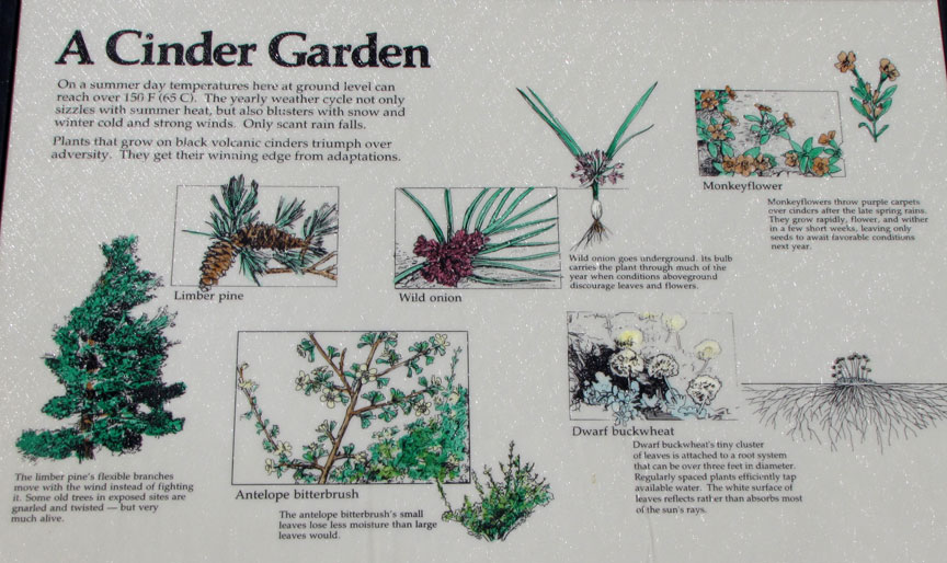
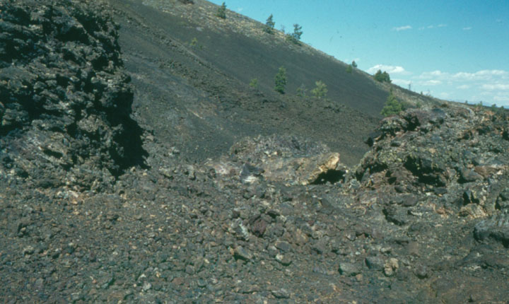
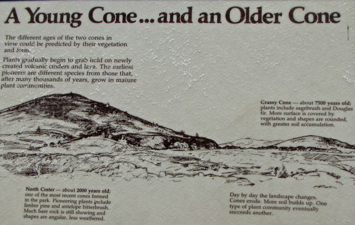
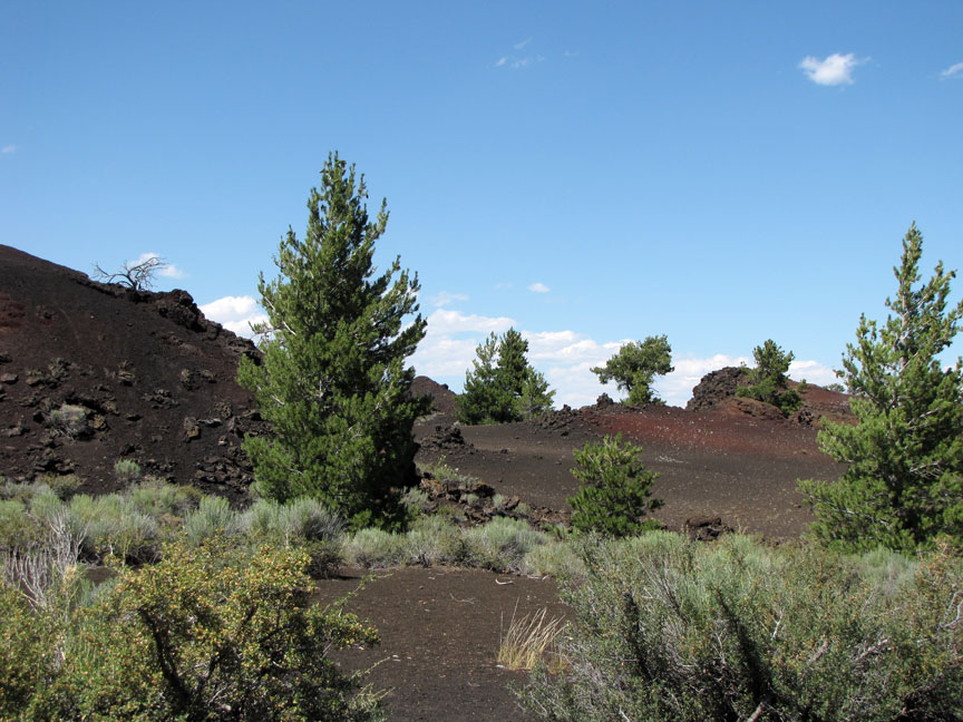
Total average precipitation in the Craters of the Moon area is between 15–20 inches (380–510 mm) per year. Most of this is lost in cracks in the basalt, only to emerge later in springs and seeps in the walls of the Snake River Canyon. Older lava fields on the plain have been invaded by drought-resistant plants such as sagebrush, while younger fields, such as Craters of the Moon, only have a seasonal and very sparse cover of vegetation. From a distance this cover disappears almost entirely, giving an impression of utter black desolation. Repeated lava flows over the last 15,000 years have raised the land surface enough to expose it to the prevailing southwesterly winds, which help to keep the area dry. Together these conditions make life on the lava field difficult.
inside a lava tube
(note the collapse of part of the tunnel ceiling)
Paleo-Indians visited the area about 12,000 years ago but did not leave much archaeological evidence. Northern Shoshone created trails through the Craters of the Moon Lava Field during their summer migrations from the Snake River to the Camas Prairie, west of the lava field. Stone windbreaks at Indian Tunnel were used to protect campsites from the dry summer wind. No evidence exists for permanent habitation by any Native American group. A hunting and gathering culture, the Northern Shoshone pursued Elk, bears, American Bison, Cougars, and Bighorn Sheep—all large game who no longer range the area. The most recent volcanic eruptions ended about 2,100 years ago and were likely witnessed by the Shoshone people. Shoshone legend speaks of a serpent on a mountain who, angered by lightning, coiled around and squeezed the mountain until liquid rock flowed, fire shot from cracks, and the mountain exploded.
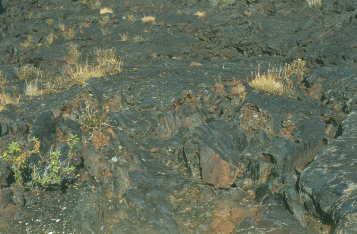
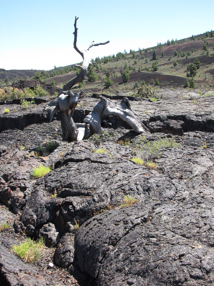
vegetation starting on the broken up lava flow
European fur trappers avoided the lava field area below the Pioneer Mountains by
following Indian trails. Early white pioneers who sought gold, affordable farm
land to raise crops, or cheap ranch land to range cattle also avoided the lava
fields and considered them useless.
Big Southern Butte was used as a landmark by pioneers.

Pioneers traveling in wagon trains on the Oregon Trail in the 1850s and 1860s
followed an alternate route in the area that used old Indian trails that skirted
the lava flows. This alternate route was later named Goodale's Cutoff and part
of it is located in the northern part of the monument. The cutoff was created to
reduce the possibility of ambush by Shoshone warriors along the Snake River such
as the one that occurred at Massacre Rocks, which today is memorialized in
Idaho's Massacre Rocks State Park.
After gold was discovered in the Salmon River area of Idaho, a group of
emigrants persuaded an Illinois-born trapper and trader named Tim Goodale to
lead them through the cutoff. A large wagon train left in July 1862 and met up
with more wagons at Craters of the Moon Lava Field. Numbering 795 men and 300
women and children, the unusually large group was relatively unmolested during
its journey and named the cutoff for their guide. Improvements to the cutoff
such as adding a ferry to cross the Snake River made it into a popular alternate
route of the Oregon Trail.
In 1879, two Arco cattlemen named Arthur Ferris and J.W. Powell became the first
known people to explore the lava fields. They were investigating its possible
use for grazing and watering cattle but found the area to be unsuitable and
left.
U.S. Army Captain and western explorer B.L.E. Bonneville visited the lava fields
and other places in the West in the 19th century and wrote about his experiences
in his diaries. Washington Irving later used Bonneville's diaries to write the
Adventures of Captain Bonneville, saying this unnamed lava field is a place
"where nothing meets the eye but a desolate and awful waste, where no grass
grows nor water runs, and where nothing is to be seen but lava."
In 1901 and 1903, Israel Russell became the first geologist to study this area
while surveying it for the United States Geological Survey (USGS). In 1910,
Samuel Paisley continued Russell's work and later became the monument's first
custodian. Others followed and in time much of the mystery surrounding this and
the other Lava Beds of Idaho was lifted.

The few whites who visited the area in the 19th century created local legends
that it looked like the surface of the Moon. Geologists Harold T. Stearns coined
the name "Craters of the Moon" in 1923 while trying to convince the National
Park Service to recommend protection of the area in a national monument.
Robert Limbert, a sometime taxidermist, tanner, and furrier from Boise, explored
the area, which he described as "practically unknown and unexplored ..." in the
1920s after hearing stories from fur trappers about "strange things they had
seen while ranging the region".
The black soil on Inferno Cone exhibits the properties Limbert wrote about.
Limbert wrote: "I had made two trips into the northern end, covering practically
the same region as that traversed by a Geological Survey party in 1901. My first
was a hiking and camping trip with Ad Santel (the wrestler), Dr. Dresser, and
Albert Jones; the second was with Wes Watson and Era Martin (ranchers living
about four miles [6 km] from the northern edge). The peculiar features seen on
those trips led me to take a third across the region in the hope that even more
interesting phenomena might be encountered." Limbert set out on his third and
most ambitious foray to the area in May 1920, this time with Walter L. Cole and
an Airedale Terrier to accompany him. Starting from Minidoka, Idaho, they
explored what is now the monument area from south to north passing Two Point
Butte, Echo Crater, Big Craters, North Crater Flow, and out of the lava field
through the Yellowstone Park and Lincoln Highway (now known as the Old
Arco-Carey Road). Taking the dog along was a mistake, Limbert wrote, "for after
three days' travel his feet were worn and bleeding".
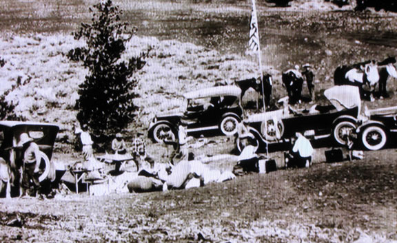
early visitors to the Monument
A series of newspaper and magazine articles written by Limbert were later published about this and previous treks, which increased public awareness of the area. The most famous of these was an article that appeared in a 1924 issue of National Geographic where he called the area "Craters of the Moon," helping to solidify the use of that name. In the article he had this to say about the cobalt blue of the Blue Dragon Flows:

"It is the play of light at sunset across this lava that charms the spectator.
It becomes a twisted, wavy sea. In the moonlight its glazed surface has a
silvery sheen. With changing conditions of light and air, it varies also, even
while one stands and watches. It is a place of color and silence ..."
Management sections. Together the NPS Developed Area and NPS Wilderness Area
made up the 1970 to 2000 extent of the Monument.
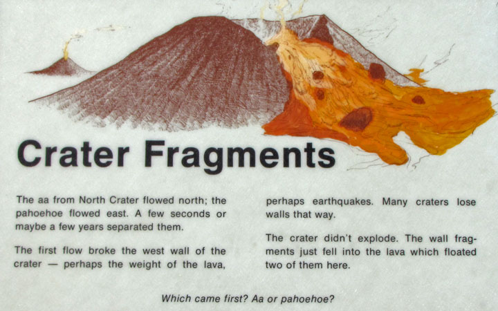
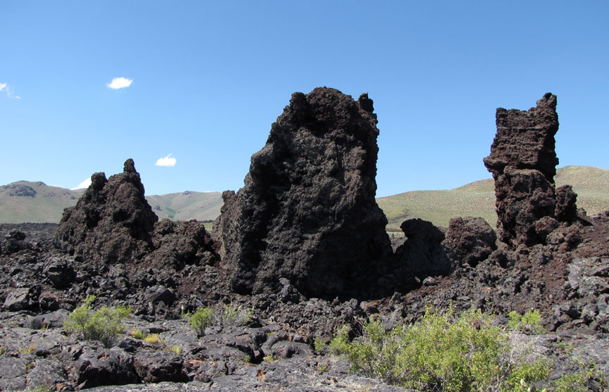
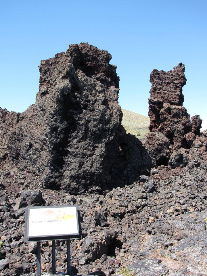
Crater fragments
In large part due to Limbert's work, Craters of the Moon National Monument was proclaimed on May 2, 1924 by U.S. President Calvin Coolidge to "preserve the unusual and weird volcanic formations". The Craters Inn and several cabins were built in 1927 for the convenience of visitors. The Mission 66 Program initiated construction of today's road system, visitor center, shop, campground and comfort station in 1956 and in 1959 the Craters of the Moon Natural History Association was formed to assist the monument in educational activities. The addition of an island of vegetation completely surrounded by lava known as Carey Kipuka (air photo) increased the size of the monument by 5,360 acres (22 km2) in 1962.
cinder cone (1957)
Since then the monument has been enlarged. On October 23, 1970, Congress set aside a large part of it—43,243 acres (175 km2)—as Craters of the Moon National Wilderness, protecting that part under the National Wilderness Preservation System.
From 1969 to 1972, NASA visited the real Moon through the Apollo program and
found that its surface does not closely resemble this part of Idaho. NASA
astronauts discovered that real Moon craters were almost all created by
meteorites while their namesakes on Earth were created by volcanic
eruptions; both are desolate. Apollo astronauts performed part of their
training at Craters of the Moon Lava Field by learning to look for and collect
good rock specimens in an unfamiliar and harsh environment.
For many years, geologists, biologists and environmentalists have advocated for
expansion of the monument and its transformation into a national park. Part of
that goal was reached in 2000 when the monument was expanded 13-fold from 53,545
acres (217 km2) to its current size to encompass the entire Great Rift zone and
its three lava fields. The entire addition is called the Backcountry Area while
the two older parts are called the Developed Area and Wilderness Area.
Opposition by cattle interests and hunters to a simple expansion plan led to a
compromise of having the addition become a national preserve in 2002 (which
allows hunting, not ordinarily permitted in national parks and monuments in the
U.S.). Craters of the Moon National Monument and Preserve is co-managed by the
National Park Service and the Bureau of Land Management, both under the
Department of the Interior.
lava (1957)
The Snake River Plain is a volcanic province that was created by a series of cataclysmic caldera-forming super-eruptions which started about 15 million years ago. A migrating hotspot thought to now exist under Yellowstone Caldera in Yellowstone National Park has been implicated. This hot spot was under the Craters of the Moon area some 10 to 11 million years ago but 'moved' as the North American Plate migrated southwestward. Pressure from the hot spot heaves the land surface up, creating fault-block mountains. After the hot spot passes the pressure is released and the land subsides.
2010
Leftover heat from this hot spot was later liberated by Basin and Range-associated rifting and created the many overlapping lava flows that make up the Lava Beds of Idaho. The largest rift zone is the Great Rift; it is from this 'Great Rift fissure system' that Craters of the Moon, Kings Bowl, and Wapi lava fields were created.
In spite of their fresh appearance, the oldest flows in the Craters of the Moon
Lava Field are 15,000 years old and the youngest erupted about 2000 years ago,
according to Mel Kuntz and other USGS geologists. Nevertheless the volcanic
fissures at Craters of the Moon are considered to be dormant, not extinct, and
are expected to erupt in less than a thousand years. There are eight major
eruptive periods recognized in the Craters of the Moon Lava Field. Each period
lasted about 1000 years or less and were separated by relatively quiet periods
that lasted between 500 to as long as 3000 years.
Kings Bowl Lava Field erupted during a single fissure eruption on the southern
part of the Great Rift about 2,250 years ago. This eruption probably lasted only
a few hours to a few days. The field preserves explosion pits, lava lakes,
squeeze-ups, basalt mounds, and an ash blanket. The Wapi Lava Field probably
formed from a fissure eruption at the same time as the Kings Bowl eruption. More
prolonged activity over a period of months to a few years led to the formation
of low shield volcanos-(?) in the Wapi field. The Bear Trap lava tube, located
between the Craters of the Moon and the Wapi lava fields, is a cave system more
than 15 miles (24 km) long. The lava tube is remarkable for its length and for
the number of well-preserved lava cave features, such as lava stalactites and
curbs, the latter marking high stands of the flowing lava forever frozen on the
lava tube walls. The lava tubes and pit craters of the monument are known for
their unusual preservation of winter ice and snow into the hot summer months,
due to shielding from the sun and the insulating properties of basalt.
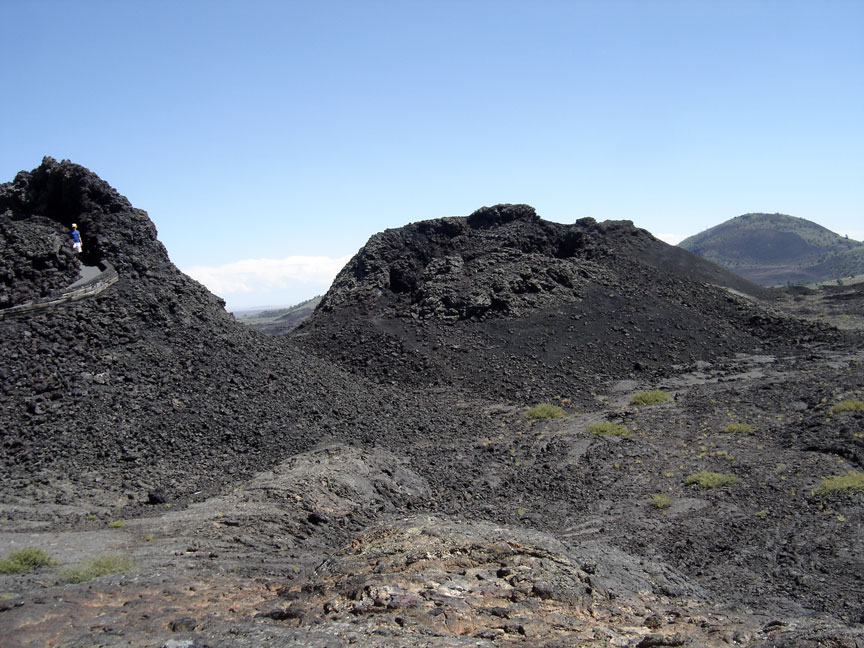
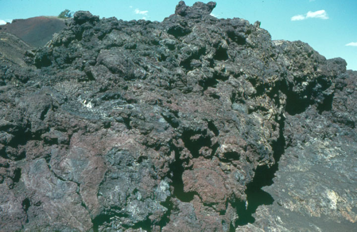
spatter cones
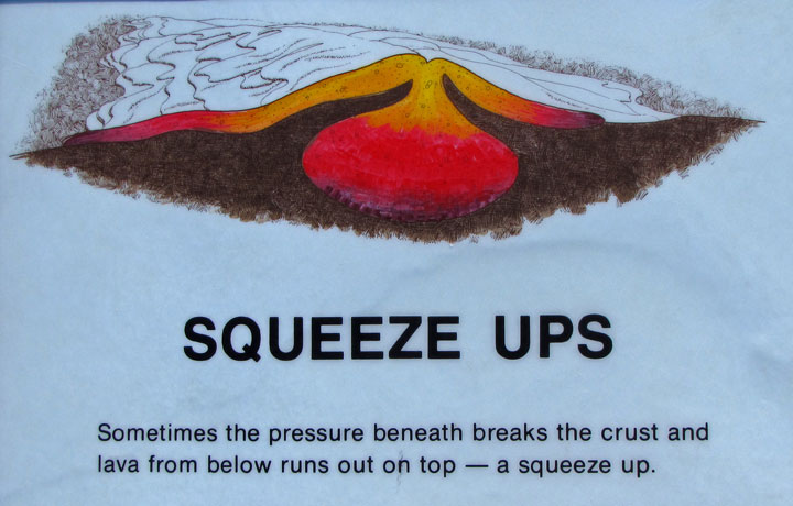
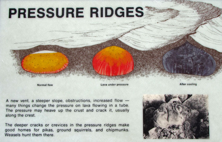
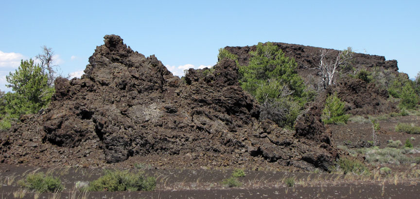
A typical eruption along the Great Rift and similar basaltic rift systems starts with a curtain of very fluid lava shooting up to 1,000 feet (300 m) high along a segment of the rift up to 1 mile (1.6 km) long. As the eruption continues, pressure and heat decrease and the chemistry of the lava becomes slightly more silica rich. The curtain of lava responds by breaking apart into separate vents. Various types of volcanos may form at these vents: gas-rich pulverized lava creates cinder cones , and pasty lava blobs form spatter cones (such as Spatter Cones – stop 5). Later stages of an eruption push lava streams out through the side or base of cinder cones, which usually ends the life of the cinder cone (North Crater, Watchmen, and Sheep Trail Butte are notable exceptions). This will sometimes breach part of the cone and carry it away as large and craggy blocks of cinder (as seen at North Crater Flow – stop 2 – and Devils Orchard – stop 3). Solid crust forms over lava streams and lava tubes (a type of cave), and are created when lava vacates its course (examples can be seen at the Cave Area – stop 7).
Geologists feared that a large earthquake that shook Borah Peak, Idaho's tallest
mountain, in 1983 would restart volcanic activity at Craters of the Moon, though
this proved not to be the case. Geologists predict that the area will experience
its next eruption some time in the next 900 years with the most likely period in
the next 100 years.
Text from Wikipedia