
Cape Verde Islands
photos and comments courtesy of
Francisco Santos
Santiago Island
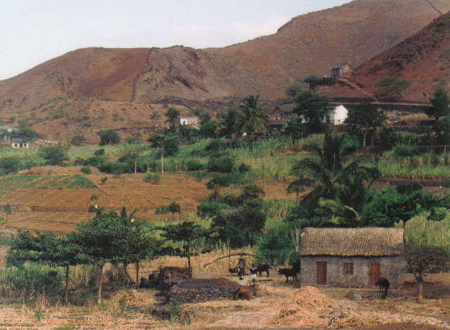
Santiago (also spelled São Tiago or Sant'Iago) is the biggest island of the archipelago. It was the first to be discovered by the Portuguese navigators, in the 15th century. It was the first to be settled (followed by Fogo). It has more than half of the population in the archipelago. Santiago is also dry, but its hinterland has big mountains and some humidity that allows some farming.
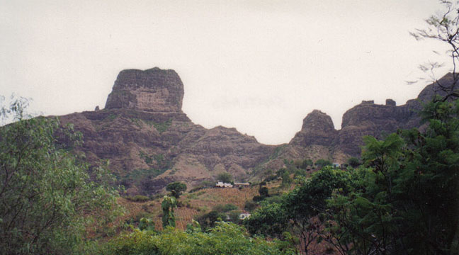
Santiago Island. Mountains of the interior.
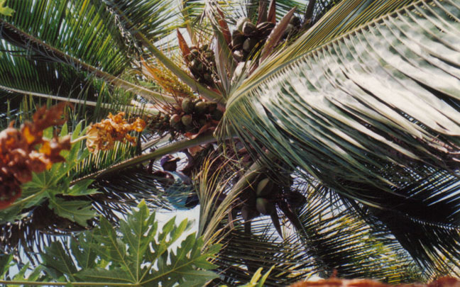
Interior of Santiago Island. Harvesting coconuts
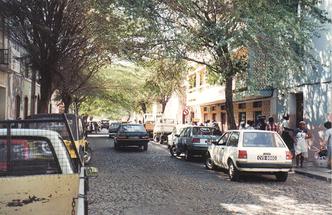
Praia city, Santiago Island.
Praia, or Cidade da Praia ("city of beach"), is the capital of Cape Verde.
A main street of downtown, which is on the top of a plateau, known precisely as
Platô.
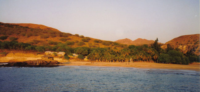
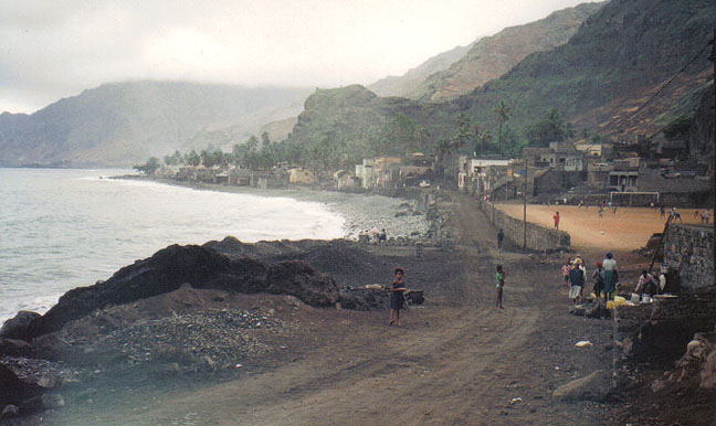
Tarrafal, Santiago Island.
The bay and beach of Tarrafal, in on the northern tip of Santiago Island.
The little houses are part of a tourist resort, which is relatively well
integrated in the landscape.
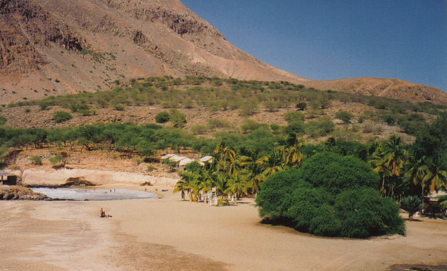
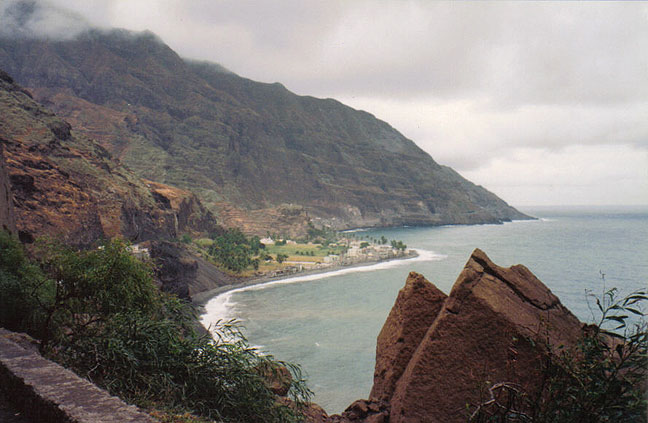
Tarrafal, Santiago Island.
Despite the beauty of its beach, Tarrafal is
infamous due to its former Concentration Camp.
The Portuguese colonial-fascist regime built near the town of Tarrafal a
Concentration Camp where many opponents to the regime were imprisoned, tortured
and many died. The victims of Tarrafal prison were both antifascist, democratic
Portuguese activists and African members of liberation movements in the
Portuguese colonies.
Even today the word "tarrafal" is used to mean something very bad and horrible.
The hell of the Tarrafal concentration camp ended in 1974, after the April 25
revolution in Portugal,
that led to the end of the colonial war.
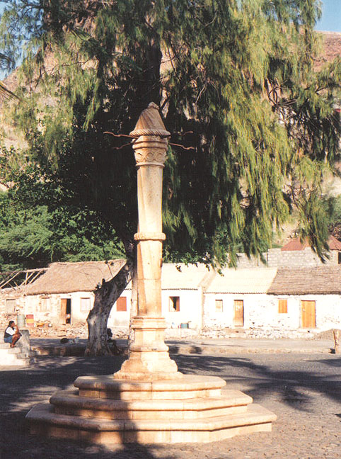
Cidade Velha, Santiago Island.
This is the Pelourinho (pillory), where they used to gather the slaves, in the
town's main square.
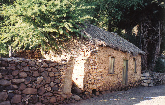
Cidade Velha, Santiago Island.
Old thatchered stone houses.
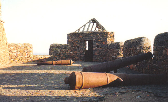
Fortaleza de São Filipe, Cidade Velha, Santiago.
![]()
Santo Antão
Santo Antão Island
the Northern shore.
Pombas, Santo Antão Island
Pombas, or Vila das Pombas ("town of the
doves") is a village in the Northeast of Santo Antão, on the wet shore.
The landscape of Santo Antão is the most spectacular of all the Cape Verde
Islands. A stunning, extensive mountain range divides the island into two
sections, one to the north and the other to the south. The north (as well as the
higher mountains) is humid, while the south is dry like the neighbor São Vicente
Island. The altitude reaches 1,979 metres in Tope de Coroa.
(Notice the well cared soccer field.)
Ribeira da Cruz, Santo Antão Island. Ribeira da
Cruz ("small river of the cross")
is another valley in the northern, wet shore of Santo Antão Island, with
many farms.
Francisco Santos'
mother-in-law was born in São Vicente Island,
but her father came from this place in Santo Antão (she has also "da Cruz" in
her name, has well as his wife);
her mother was born in São NIcolau Island.
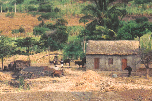
Ribeira da Cruz, Santo Antão Island.
In this detail you see the "trapiche".
Moved by the force of animals (bulls, horses, etc),
the trapiche is the "device" (a mill, in English) to get the juice of the sugar
cane.
With that they make the famous Santo Antão's grog or aguardente (rhum)
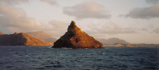
Ilhéu dos Pássaros ("islet of the birds"),
called in Creole as Djéu.
This islet has only one lighthouse. It is at the entrance of the Porto Grande,
São Vicente Island.
This photo was taken at sunset on board of the ferry from Santo Antão Island to
São Vicente Island.
![]()
Return to Cape Verde (São Vicente) page


Return to Atlantic Islands page


![]()